Indonesia’s Mount Soputan erupts on tsunami-hit island

Indonesia's Mount Soputan volcano spews lava and ash during an eruption as seen from Silian 3 village in Minahasa Tenggara, Indonesia's Sulawesi island, January 5, 2016 in this photo taken by Antara Foto. REUTERS/Adwit B Pramono/Antara Foto ATTENTION EDITORS - THIS IMAGE HAS BEEN SUPPLIED BY A THIRD PARTY. IT IS DISTRIBUTED, EXACTLY AS RECEIVED BY REUTERS, AS A SERVICE TO CLIENTS. FOR EDITORIAL USE ONLY. NOT FOR SALE FOR MARKETING OR ADVERTISING CAMPAIGNS. MANDATORY CREDIT. INDONESIA OUT. NO COMMERCIAL OR EDITORIAL SALES IN INDONESIA. TPX IMAGES OF THE DAY

Indonesia’s Mount Soputan volcano spews lava and ash during an eruption as seen from Silian 3 village in Minahasa Tenggara, Indonesia’s Sulawesi island, January 5, 2016 in this photo taken by Antara Foto. REUTERS/Adwit B Pramono/Antara Foto 

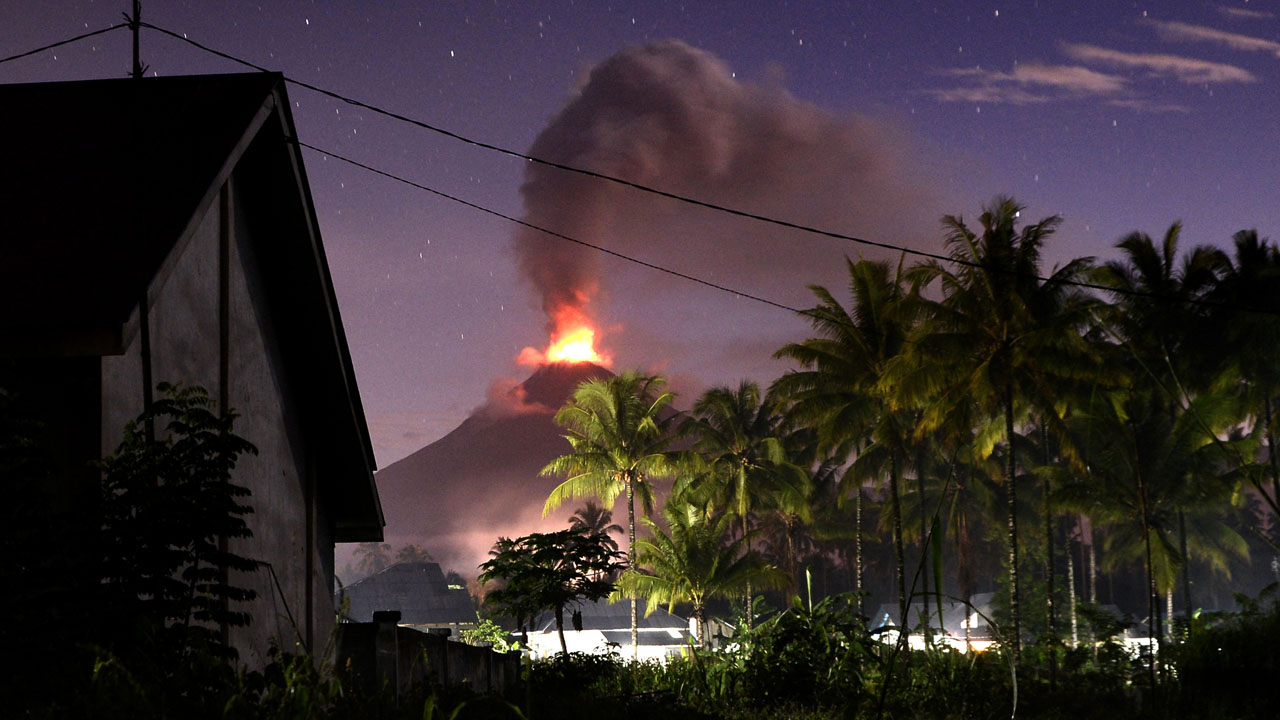
Indonesia’s Mount Soputan volcano on the quake-and tsunami-hit island of Sulawesi erupted Wednesday, spewing volcanic ash 4,000 metres into the air.

The state disaster agency warned people to stay at least four kilometres (two and a half miles) away but said there was no need to evacuate for the time being.

Images showed an eruption visible for miles around, with a cloud of ash climbing in a large vertical column with a mushroom-shaped top.

Soputan is around 1,000 kilometres from the town of Palu where a 7.5 magnitude earthquake triggered a tsunami that lashed the coastline killing almost 1,400 people.
[related ids=”751596,753680,754256″]
Indonesia is situated on the Pacific “Ring of Fire”, a vast zone of geological instability where the collision of tectonic plates causes frequent quakes and major volcanic activity.

[ad unit=2]

Join Our Channels