The question of how many states are in Nigeria might seem straightforward, but there’s actually quite a fascinating story behind the number. Whether you’re a student preparing for an exam, a curious citizen, or someone planning to visit every corner of our great nation, understanding Nigeria’s state structure is rather like understanding the country’s very identity.
Understanding Nigeria’s 36 States and Federal Capital Territory
Nigeria currently comprises 36 states plus the Federal Capital Territory (FCT), Abuja. This structure didn’t happen overnight, mind you.
When I first started my journalism career, I made it my mission to visit each state. The diversity was staggering! From the bustling streets of Lagos to the serene landscapes of Taraba, each state felt like its own country within a country.
The 1999 Constitution of the Federal Republic of Nigeria officially recognises these 36 states. The FCT, whilst not technically a state, functions with similar administrative powers and is often counted when discussing Nigeria’s federal structure. Understanding this diversity becomes even more fascinating when you consider why Nigeria is culturally diverse, with each state contributing unique traditions and languages to our national tapestry.
How the Current 36 States Came to Be
Nigeria’s journey to 36 states is a tale of political evolution spanning decades. We started with just three regions at independence in 1960.
The state creation exercise has been ongoing since 1967. General Yakubu Gowon created 12 states that year, breaking up the old regional system. Subsequent military governments continued this process: 19 states in 1976, 21 in 1987, 30 in 1991, and finally 36 in 1996 under General Sani Abacha.
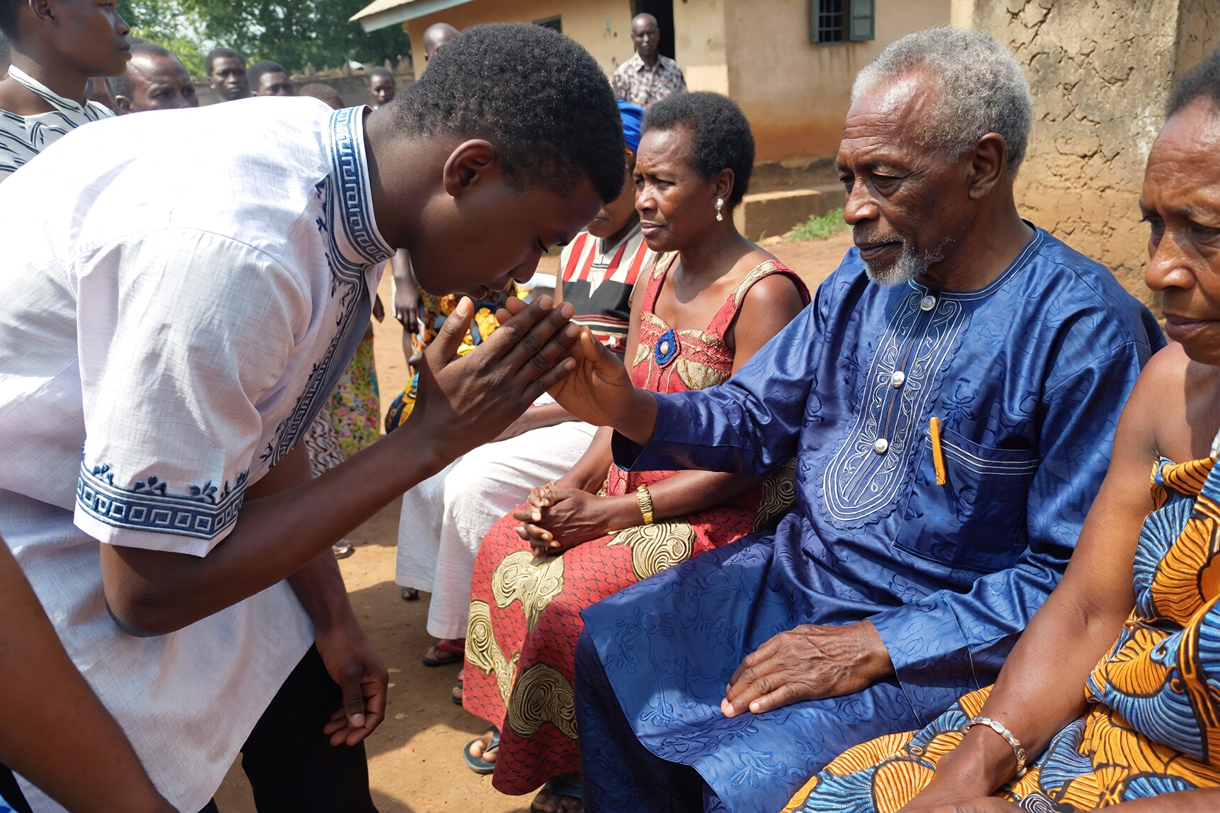
I remember my grandfather telling me about the excitement when his region became a state. There was dancing in the streets! People felt they’d finally have a voice in governance, closer to home. The creation of new states was meant to bring development closer to the people and reduce ethnic tensions.
Each creation exercise followed constitutional procedures, though under military rule these were often swift. The National Assembly now has the constitutional power to create new states, though this hasn’t happened since 1996. The process requires a two-thirds majority vote and approval from the affected states through referendum. Interestingly, Guardian Nigeria recently reported that 46 formal requests for new states have been submitted to the House of Representatives Committee on Constitutional Review.
A Complete List of Nigeria’s States by Geopolitical Zone
Let me break this down for you in a way that makes geographical sense. Nigeria is divided into six geopolitical zones, each with its unique character.
North-Central (Middle Belt): Benue, Kogi, Kwara, Nasarawa, Niger, Plateau, and FCT Abuja. This zone serves rather like a buffer between the predominantly Muslim north and Christian south.
North-East: Adamawa, Bauchi, Borno, Gombe, Taraba, and Yobe. I travelled through here extensively, and the resilience of the people despite security challenges is truly inspiring.
North-West: Jigawa, Kaduna, Kano, Katsina, Kebbi, Sokoto, and Zamfara. The commercial hub of Kano alone is worth an article!
South-East: Abia, Anambra, Ebonyi, Enugu, and Imo. Five states that pack tremendous economic punch through trade and industry.
South-South: Akwa Ibom, Bayelsa, Cross River, Delta, Edo, and Rivers. Nigeria’s oil wealth comes predominantly from this region.
South-West: Ekiti, Lagos, Ogun, Ondo, Osun, and Oyo. Lagos alone has an economy that rivals some African countries.
5 Simple Steps to Remember All 36 Nigerian States
Learning all 36 states might seem daunting, but here’s how I taught my younger sister to memorise them:
- Start with your zone: Learn the states in your geopolitical zone first. You probably already know most of them from news and personal connections.
- Use alphabetical chunking: Group states alphabetically in sets of six (Abia to Benue, Cross River to Gombe, etc.). This breaks the task into manageable portions.
- Create zone associations: Link each zone to something memorable. South-West equals Yoruba culture, South-East equals Igbo commerce, and so forth.
- Map visualization: Get a map of Nigeria and trace each state with your finger whilst saying its name aloud. Visual and kinesthetic learning work wonders together.
- Quiz yourself regularly: Use the car number plate game. Every Nigerian vehicle plate shows its state of registration. When you’re stuck in Lagos traffic (inevitable!), identify the states on surrounding vehicles.
I used this method to teach secondary school students, and within two weeks, they could rattle off all 36 states forwards and backwards.
What Is the Largest State in Nigeria by Land Area?
Niger State holds the crown as Nigeria’s biggest state by landmass, covering approximately 76,363 square kilometres. That’s roughly the size of Scotland!
When I visited Niger State for a story, the sheer vastness became apparent. We drove for hours through different landscapes within the same state. The Federal Ministry of Lands, Housing and Urban Development maintains comprehensive records of land area measurements, and Niger State consistently tops the charts.
Interestingly, whilst Niger State is the largest, it’s not the most populous. That distinction belongs to Lagos State (more on that shortly). Niger State’s capital, Minna, feels worlds apart from the state’s rural expanses, where communities are separated by vast distances.
Borno State comes second at approximately 70,898 square kilometres, followed by Taraba State with 54,473 square kilometres. These northern states dominate the size rankings, which makes sense when you consider the geographical realities of the Sahel region.
Nigerian States by Size: Key Measurements
| State | Area (km²) | Geopolitical Zone | Population Density (per km²) |
|---|---|---|---|
| Niger | 76,363 | North-Central | 68 |
| Borno | 70,898 | North-East | 73 |
| Taraba | 54,473 | North-East | 54 |
| Kaduna | 46,053 | North-West | 178 |
| Bauchi | 45,837 | North-East | 142 |
| Yobe | 45,502 | North-East | 66 |
| Zamfara | 39,762 | North-West | 112 |
| Adamawa | 36,917 | North-East | 119 |
| Kebbi | 36,800 | North-West | 116 |
| Kano | 20,131 | North-West | 663 |
The table reveals a fascinating pattern: larger states tend to have lower population densities, whilst smaller states like Kano pack significantly more people per square kilometre. This disparity affects everything from service delivery to political representation.
How Many States Currently Exist in Nigeria Today?
Let me address this directly because confusion often arises. Nigeria has exactly 36 states plus the Federal Capital Territory, Abuja. This number has remained constant since October 1996, when the last state creation exercise added six new states during General Abacha’s military regime.
Some people mistakenly count the FCT as a 37th state, but technically, it’s administered differently. The FCT falls under direct federal control, whereas states have their own governors and state assemblies. Think of it rather like how Washington D.C. operates separately from the 50 American states.
The Nigerian National Population Commission uses these 36 states plus the FCT as the basis for census data collection and demographic analysis. For planning purposes, government ministries operate on this 36 plus 1 framework.
There’s been ongoing agitation for new states, particularly in the South-East, which currently has only five states compared to six or seven in other zones. The debate intensifies every few years, with passionate arguments on both sides about whether creating more states aids development or simply multiplies administrative costs.
Which State Holds the Title of Richest in Nigeria?
Lagos State indisputably claims the title of Nigeria’s richest state, with an internally generated revenue (IGR) of over ₦651 billion in 2023. That’s more than the next three highest-earning states combined!
I’ll never forget attending a budget presentation at the Lagos State House of Assembly. The sheer scale of the state’s economic activity was mind-boggling. Lagos accounts for approximately 30% of Nigeria’s entire GDP, despite occupying less than 0.4% of the country’s landmass.
Rivers State comes second in the wealth rankings, bolstered by its oil production and the presence of major petroleum companies in Port Harcourt. The state’s IGR consistently exceeds ₦150 billion annually, though it’s worth noting that much of this wealth is concentrated in urban areas.
Ogun State, benefiting from its proximity to Lagos and hosting numerous manufacturing companies along the Lagos-Ibadan corridor, ranks third. Delta, Kano, and Kaduna States round out the top six, each with distinct economic advantages.
What makes a state “rich” isn’t just oil revenue, mind you. Lagos proves that strategic location, robust taxation systems, and business-friendly policies can generate enormous wealth. The Federal Inland Revenue Service works closely with state revenue authorities to optimise tax collection and revenue generation.
Contrarily, states in the North-East and some parts of the North-West struggle economically, often dependent on monthly federal allocations to meet basic obligations. The disparity between Lagos and, say, Yobe State is rather like comparing London to a rural English county, but even more pronounced.
Guardian Nigeria’s extensive tourism series on 36 states as Nigerian destinations highlights how each state, regardless of current economic status, possesses unique natural and cultural wealth worth exploring.
The Direct Answer: Nigeria’s State Structure Explained
So, how many states are in Nigeria? The answer is unequivocal: 36 states plus the Federal Capital Territory (FCT), Abuja.
These 36 states are:
Abia, Adamawa, Akwa Ibom, Anambra, Bauchi, Bayelsa, Benue, Borno, Cross River, Delta, Ebonyi, Edo, Ekiti, Enugu, Gombe, Imo, Jigawa, Kaduna, Kano, Katsina, Kebbi, Kogi, Kwara, Lagos, Nasarawa, Niger, Ogun, Ondo, Osun, Oyo, Plateau, Rivers, Sokoto, Taraba, Yobe, and Zamfara.
Each state has its own governor, state assembly, judiciary, and civil service. They exercise considerable autonomy in areas like education, health, agriculture, and infrastructure development, whilst the federal government handles defence, foreign affairs, currency, and interstate matters.
The FCT, though not a state, functions similarly but reports directly to the Federal Government through the Minister of the FCT rather than an elected governor. Abuja’s unique status stems from its role as Nigeria’s capital, requiring special security and administrative arrangements.
This 36-state structure, combined with the FCT, creates 37 administrative units across six geopolitical zones. The system aims to balance regional representation, bring government closer to the people, and ensure equitable development, though the reality sometimes falls short of these noble ideals.
Exploring Nigeria’s Geographic and Cultural Diversity
Beyond the numbers, Nigeria’s states represent an extraordinary mosaic of cultures, languages, and landscapes. Each state tells its own story.
Take Plateau State, for example. Known as the “Home of Peace and Tourism,” it boasts temperate climate conditions rare in Nigeria. Jos, the capital, sits on the Jos Plateau at about 1,200 metres above sea level, making it one of Nigeria’s coolest cities. I’ve worn a jumper in Jos in December whilst my friends in Lagos were sweating buckets!
Or consider Bayelsa State, the youngest state (created in 1996), which is almost entirely covered by water. The Guardian Nigeria reported on how Bayelsa’s unique geography shapes everything from architecture to transportation, with boats being as common as cars.
Cross River State markets itself as “The People’s Paradise” and hosts the Calabar Carnival, often called Africa’s biggest street party. When I attended in 2019, the international tourists outnumbered Nigerians in some hotel lobbies! The state’s investment in tourism infrastructure shows what’s possible when states leverage their unique advantages.
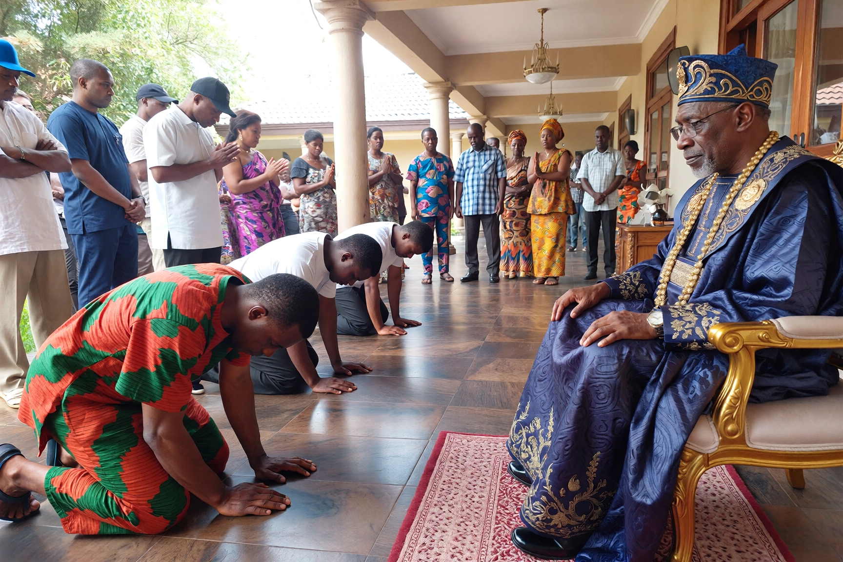
Understanding this diversity helps answer another common question: what is Nigerian society like? Our 36 states create a federation where Hausa-Fulani, Yoruba, Igbo, Ijaw, Kanuri, Tiv, and hundreds of other ethnic groups coexist, each bringing distinct worldviews, traditions, and contributions to our national character.
Bringing It All Together: Why Nigeria’s State Structure Matters
Understanding how many states Nigeria has goes beyond memorising numbers for an exam. It’s about grasping the fundamental structure of our federation and how it affects governance, resource allocation, and national identity.
The 36-state framework, established in 1996, represents an attempt to balance competing demands: regional autonomy versus national unity, ethnic representation versus economic viability, and local governance versus federal control. Whether it succeeds depends on whom you ask!
Some argue that 36 states are too many, creating unnecessary administrative costs and weak states that can barely function without federal allocations. Others contend that we need more states, particularly in regions like the South-East, to ensure fair representation and bring government even closer to the people.
Whatever your position, the reality remains that these 36 states, each with its capital, government, and unique character, form the foundation of Nigerian federalism. From the economic powerhouse of Lagos to the agricultural heartland of Benue (the nation’s “Food Basket”), from the oil-rich waters of Rivers to the historic cities of Kano and Sokoto, each state contributes something irreplaceable to our national tapestry.
If you’re planning to explore Nigeria’s diverse landscape, consider reading about the best time to visit Nigeria and whether it’s safe to visit Nigeria to help plan your journey across our remarkable 36 states.
Key Takeaways
- Nigeria has exactly 36 states plus the Federal Capital Territory (Abuja), a structure established in 1996 that has remained unchanged for nearly three decades.
- Niger State is Nigeria’s largest by land area (76,363 km²), whilst Lagos State is the richest with over ₦651 billion in internally generated revenue, demonstrating that economic power doesn’t always correlate with geographical size.
- The six geopolitical zones (North-Central, North-East, North-West, South-East, South-South, and South-West) organise these 36 states into distinct regional blocs, each with unique cultural, economic, and political characteristics that shape Nigeria’s federal system.
FAQ: Everything You Need to Know About How Many States Are in Nigeria
How many states are there in Nigeria in 2024?
Nigeria has 36 states plus the Federal Capital Territory (FCT), Abuja. This number has remained constant since 1996 when the last state creation exercise was conducted under General Sani Abacha’s military government.
What are the names of all 36 states in Nigeria?
The 36 states are: Abia, Adamawa, Akwa Ibom, Anambra, Bauchi, Bayelsa, Benue, Borno, Cross River, Delta, Ebonyi, Edo, Ekiti, Enugu, Gombe, Imo, Jigawa, Kaduna, Kano, Katsina, Kebbi, Kogi, Kwara, Lagos, Nasarawa, Niger, Ogun, Ondo, Osun, Oyo, Plateau, Rivers, Sokoto, Taraba, Yobe, and Zamfara. Each state has its own capital city, governor, state assembly, and administrative structure.
Is Abuja counted as the 37th state of Nigeria?
No, Abuja is not technically a state but rather the Federal Capital Territory (FCT) administered directly by the Federal Government. Unlike states with elected governors, the FCT is overseen by a Minister appointed by the President, though it functions similarly to states in many administrative respects.
Which state is the largest in Nigeria by land area?
Niger State is Nigeria’s largest state, covering approximately 76,363 square kilometres. This makes it larger than some African countries, including Togo and Sierra Leone, and roughly equivalent to the size of Scotland.
Which Nigerian state has the highest population?
Lagos State has Nigeria’s highest population, with estimates ranging from 15 to 20 million people (official figures vary). The state’s economic opportunities attract migrants from across Nigeria and West Africa, making it one of Africa’s fastest-growing megacities.
What is the smallest state in Nigeria?
Lagos State is Nigeria’s smallest state by land area, covering only 3,577 square kilometres. Despite its small size, it’s Nigeria’s economic powerhouse and most populous state, demonstrating that geographical size doesn’t determine economic or political importance.
How many geopolitical zones does Nigeria have?
Nigeria has six geopolitical zones: North-Central, North-East, North-West, South-East, South-South, and South-West. These zones, whilst not constitutionally recognised, play significant roles in political appointments, resource allocation, and ensuring regional balance in governance.
Which state was created most recently in Nigeria?
Six states were created simultaneously in 1996, making them Nigeria’s youngest: Bayelsa, Ebonyi, Ekiti, Gombe, Nasarawa, and Zamfara. Since then, no new states have been created, though numerous proposals exist, particularly for a sixth state in the South-East zone.
Can new states still be created in Nigeria?
Yes, the 1999 Constitution allows for the creation of new states through a constitutional amendment process. This requires a two-thirds majority in the National Assembly and approval from at least 24 state Houses of Assembly, plus a referendum in the affected areas.
Which state is the richest in Nigeria?
Lagos State is unquestionably Nigeria’s richest state, with an internally generated revenue exceeding ₦651 billion in 2023. Rivers State ranks second, followed by Ogun, Delta, Kano, and Kaduna, though Lagos’s revenue dwarfs all others combined.
How many states are in northern Nigeria?
Northern Nigeria comprises 19 states across three geopolitical zones: North-Central (7 states including FCT), North-East (6 states), and North-West (7 states). This contrasts with 17 states in southern Nigeria across three zones.
What is the significance of having 36 states in Nigeria?
The 36-state structure aims to bring governance closer to the people, ensure regional representation, balance ethnic diversity, and facilitate development by creating administrative units small enough to be manageable yet large enough to be viable. However, debates continue about whether this number optimally serves these goals or should be revised.