[dailymotion code=”k7pZJzZfGynxvEwVFJ0″ autoplay=”yes”]
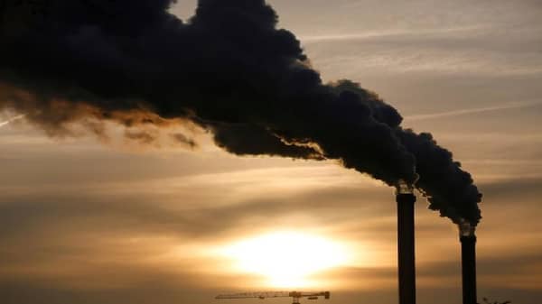
Climate change is the changes in the global climate systems over a long period, which can be yearly or in a decade compared to weather changes, which only occur daily, weekly, or monthly.
Scientifically, human activities contribute largely to the causes of climate change, for example, the Food and Agriculture Organization of the United Nations says that deforestation is the second-leading cause of climate change. It accounts for nearly 20% of greenhouse gas emissions whereas fossil fuels account for 89% of global CO2 emissions according to the Intergovernmental Panel on Climate Change (IPCC) in 2018. Hence, the change in climate is a gradual process, which subsequently leads to the occurrence of slow-onset and sudden-onset hazards. Some of the examples of the slow onset hazards are precipitation pattern changes, sea-level rises, increasing temperatures, and desertification/drought while flooding, tsunami, and wildlife are examples of the sudden-onset hazards.
According to the United Nations Framework Convention on Climate Change (UNFCCC), slow-onset events are the “changes that evolve incrementally over several years or recurring events that become more frequent or intense.” In this article, climate change and slow-onset hazards are discussed.
Geographically, the length of the rainy season decreases from the south to the north in Nigeria. For instance, some locations that experience an average amount of annual rainfall in the past years are now experiencing an excessive amount of rainfall, exposing such locations to the risk of flooding. Meanwhile, the Nigerian Meteorological Agency (NiMET) season rainfall prediction 2021 shows that “The 2021 length of the growing season is expected to span between 110 days in the extreme north and over 300 days in the south. “Annual rainfall amounts over the country are anticipated to range between 300mm in the North and over 3000mm in the South.” Furthermore, coastal areas like Delta, Rivers, Edo, Cross River and Akwa Ibom are expected to have total rainfall amounts exceeding 2300mm. The coastal region’s total rainfall also fluctuates compared to the previous years. Unfortunately, this fluctuation and variation are compounded by climate change.
According to the United Nations Environment Programme (UNEP), the average global temperature is now 1.2 degrees Celsius above pre-industrial times. Center for Climate and Energy Solutions report on “Drought and Climate Change” established a link between rising temperature and drought. “Warmer temperatures can enhance evaporation from the soil, making periods with low precipitation drier they would be in cooler conditions. Droughts can persist through a “positive feedback,” where very dry soils and diminished plant cover can further suppress rainfall in an already dry area.” Being exposed to drought varies across regions. For instance, the semi-arid region of northern Nigeria is more vulnerable to drought than the humid region of the southern parts. Besides, NiMET 2021 dry spelt prediction for June and July indicates a mildly dry and severe dry in some states. “The 2021 dry spell forecast for the month of June indicates a mild dry spell of fewer than 8 days in Kogi, Nasarawa, parts of Oyo, Niger, Ekiti, Adamawa, Plateau, Bauchi and Kaduna states. “A severe dry is predicted over Kebbi, Sokoto, Zamfara, Katsina, Jigawa, Yobe, and Borno may persist for up to 20 days or more. “The forecast for July to August 2021 shows a severe dry spell over northern Oyo, and most parts of Kwara as well as Adamawa.”
Sea level rise is one of the most visible manifestations of climate change, threatening large populations and a wide range of livelihoods around the world and contributes to coastal erosion, flooding, and salinization. Generally, sea-level rise is driven by changes in global mean temperature and has been persistently rising over the century primarily due to climate change. According to the United Nations Framework Convention on Climate Change (UNFCCC), climate change causes sea-level rise through the thermal expansion of the oceans. According to the National Aeronautics and Space Administration (NASA), “most of the observed sea-level rise (about 3mm per year) is coming from the meltwater of land-based ice sheets and mountain glaciers, which adds to the ocean’s volume (about 2 mm per year combined), and from thermal expansion, or the ocean water’s expansion as it warms (roughly 1 mm per year).” In Nigeria, the impact of sea-level rise is already been felt in the coastal regions like Lagos, Ondo, Delta, Bayelsa, Rivers, AkwaIbom, and Cross Rivers. For example, the 2017 flooding in Lekki in Lagos.
High possibility of reducing the level of waters at major dams that power the electrification of the country, for example, dams such as Kainji and Jebba will experience a decline in volume if necessary action is not taken to reduce the human impact that causes climate change. Also, there will be a rise in cattle transhumance and nomadic herding from a warm region to a wet region for watering. Meanwhile, vulnerability analysis of the Federal Ministry of Environment in the 2018 National Drought Plan indicates that states in the north will continue to experience higher degrees of drought vulnerability than those in the south. Hence, the Niger Delta region will be the most vulnerable to sea-level rise, increased precipitation, coastal erosion, and flooding.
Lastly, scientists predict higher sea levels of 1 to 3 meters by 2100 likely to wipe out much of Bayelsa and Lagos. The government should identify the vulnerable communities and provide interventions through the construction and rehabilitation of boreholes, dams, and safe water facilities. This will help the affected population cope with water scarcity. The urban planning authority should promote designing standards for buildings and other infrastructures, for example, minimum development setback standards for coastal regions and settlements along the flood plains. In addition, there should be effective regulations to ensure strong compliance with the spatial ordering of the land use act of a state.
Areas prone to flooding should be identified and marked as unsafe settlements. And the people living within the areas should be notified to relocate to a safer place or resettled. Lastly, the government should plan with the affected population by engaging them in the decision-making process. The participation will make the people willing to accept the government moves. The Sendai Framework for Disaster Risk Reduction (2015 -2030) emphasises the needs of every member state in the world to ensure that there is an increase in people’s access to multi-hazard early warning and disaster risk information. One of the strategies to reduce the impact of slow-onset hazards is the early communication of its occurrence with the aid of geospatial and remote sensing technology to predict the likely hazards. When the community members are better informed, the level of awareness and preparedness will increase, and there will be an improvement in their coping capacity.
In conclusion, the public should act now by letting the public office holders aware of the effects of climate change they are facing, and support leaders that will pass laws protecting the climate and environment.


