 Follow Us on Google News
 Follow Us on Google Discover
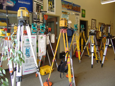
THEY seem innocuous to the average citizen. Except you require their service, their name or their equipment may not make any meaning to you. Yet they are indispensable, if we are to make judicious use of the environment.
With over 3,000 registered Surveyors nationwide, it is pertinent to identify the often neglected surveying and mining sectors as crucial to the development of institutional and infrastructural advancement of the country.
Experts say that 85 per cent of activities on the surface of the earth require mapping, thus making the surveying profession one of the foremost and primary profession in the world.
The apex mapping agency in Nigeria, the Office of the Surveyor-General of the Federation (OSGOF) is statutorily saddled with the responsibility of providing and coordinating surveying and mapping activities within the country. As the central depository for survey, mapping and geo-information activities in the country, state survey departments, oil companies, private practitioners and institutions are required by Law to inform the OSGOF of such activities.
Surveyor-General of the Federation, Prof. Peter Nwilo, underscored the relevance of the profession when he said: “Surveying is all about measurements, traditionally, measuring distances, angles with a view to determining maps or plans used for developments. As we are here, we have a coordinate, our position is known. Everything you do on the surface of the earth has a location. Our movement has a location and that location can be traced. There cannot be development without surveying and mapping whether on the surface, under the surface or in water, that information about the location must be known.
“If you attempt to develop without surveying and mapping, you are like a blind man moving in the bush trying to find a way. So it’s so important, fundamental to survey and map. One of the greatest short-comings of this country is that unfortunately those who are supposed to govern us don’t even understand the importance of surveying and mapping. The Whites that came into Nigeria to give us education, one of the first professional courses they developed was surveying. When the white man was here, the Surveyor took over from the Controller-General. It shows how they realize the importance of the profession.
“So surveying provided the fundamental data that was used for development. If you watch development and initial routes of development from the South to North and vice versa, essentially it was to get into the production areas where we had the cash crops and mineral resources and those areas were surveyed.” Nwilo said.
Describing the fundamentals of Surveying and Mapping, especially in states, Director of the Surveying and Mapping department at the Federal Capital Territory Authority, Onwukwe Okeagu, said that his unit’s task include production of survey data and accompanying maps such as topographical maps, satellite imageries and aerial photographs, acquisition and update of aerial photographs, maps and satellite imageries, physical demarcation of all categories of plots in the territory, establishment of bench marks and survey control points such as triangulation stations, primary and tertiary points.
He said that other duties are the survey and demarcation of farm lands, quarry sites, mining areas and resettlement sites, ground truthing, supervision of survey works relating to the boundaries of the FCT, charting, reporting, recording and plan preparation, maps production and reproduction, regulation of the activities of all registered Surveyors’ in the FCT and issuance of instruction to survey to all qualified Surveyors with the approval to carry out survey.
On the strategic visibility of the Nassarawa Geographical Information Systems (NAGIS), the Surveyor-General was skeptical when he said that the role of GIS is to make a map “intelligent…you cannot be talking of GIS without a map, it is from the map that you develop a GIS. When I consulted for Lagos State on mapping and GIS, the initial project was on GIS. I said to the Lagos State government that it cannot do GIS without a proper map. It is the map that gives you the GIS. They are intertwined.
Listing major specifics for surveying and mapping in relations to country growth, Nwilo, said that Nigeria must map the entire country with adequate funding for the project and have the necessary expertise for such.
He said that the country have enough surveying and mapping experts but not much funds, judging from the population and that not much attention has been put to mapping and that is why activities that can be done cheaper are not done properly because the fundamentals are neglected.
He described Geo-Spatial Information as one of the fundamentals for national development as every government projection should depend on the data.
“I must thank the Federal Government for what it has done since I came in. It has more information to help us generate data. A situation where somebody comes and says ‘do you have the old map for Enugu state’ and we say ‘we don’t have’, is that not disgraceful.” he said.
Nwilo lamented lack of political will or lackadaisical attitude of some states in surveying and mapping ventures, as they hardly commit funds to such projections noting that in most states they emphasize mostly on cadastral survey.
Cadastral survey, according to Nwilo, should be on a base map which is lacking in most of the states. He said that the Surveyor-General’s office will aim to generate one in 25,000 maps and go to higher scale to show states what they should be doing.
He declared Lagos and Nassarawa States as the “only two states that have done the right thing, indicating that Lagos State had mapped at one in 500.”
“In the civilian era, the first state to map was Cross River, but they mapped at one in 5,000 or one in 10,000 but it was not done in digital format. Delta, Rivers and Bayelsa States, started to map but have not finished or have expressed interest respectively. Anambra State has just awarded contracts, Enugu state flew (aerial photographs) and after that they abandoned it. I have tried to personally convince them to do what they should do.
“Even if you don’t want to map, get what you call Auto-photo information. I told Enugu State, finish it, pay the contractor for flying, if you have not done so. Mapping in Nigeria is at its lowest level. Abuja flew in 2007. There is no land map from it. It is supposed to flying again because the city is changing. You can imagine where Abuja was in 2007 and where it is now,” the Survey said.
He advised that new maps should be produced every five years and mentioned Kano State as one the Northern states that have done well in Surveying.
On how to curb the challenges of insecurity in the country through activities of surveying and mapping, Nwilo noted that the military should be networking with the Office of the Surveyor-General on regular basis for joint collaboration and assured that mapping will assist the country’s military especially the defense intelligence to be able to identify possible areas of enemy attacks.
He said that surveying helps to reduce land disputes, especially encroachment cases, as surveying will demarcate lands to rightful owners.
The don stated that just like every occupation creates employment for the youths, surveying creates significant community-related employment opportunities especially for community aides during field works.
He stressed the importance of political will and cited the example of his surveying consultancy services for Lagos state under the administration of Governor Raji Fashola, who heeded his advice to include Mapping activities in the state.
On how Surveying promotes ecology and forest conservation, Nwilo said that the mapping industry identifies areas of environmental sustainability including averting incidences of natural disasters adding that mapping helps identify industries that generate pollutants.
Nwilo acknowledged that surveying aids in almost all aspects of life and living including navigation and said that the most mapped countries in the world are the most developed. He regretted that quackery in the profession emanates from conveyance of practicing Surveyors and assured that disciplinary actions will be meted out to offenders.
Registrar, the Surveyors Council of Nigeria (SURCON), Windston Ayeni, traced the establishment of the Survey Council to the Minister of Works and identified Mike Onolememen as the first Nigerian minister to agree to have the department of Survey under his ministry.
Ayeni said that Surveying affects socio-economic decision making of both government and individuals, and that the need for Geospatial information is incredible.
He noted that, though the Nassarawa Geographical Information “is trying but it is really behind Rivers and Lagos, Cross Rivers states.”
The Registrar said that the collaboration with the Lands ministry will project the intended GIS summit which will ensure stakeholders will harmonize and operate for the industry”s growth and national development.
On the imperative of mapping on security and safety, Ayeni recalled how he sent a detailed Mapping proposal to the Nigerian army. He said “Three years ago I came back from a relevant conference in London, and I sent them a paper portraying an upcoming conference of Defense Intelligence Mapping in the United Kingdom for them to attend before the emergency of Boko Haram, and then the insurgency came and as we speak I don’t think they have information as to strategic information. The use of mapping is 15 years behind.
“There is a man we just buried, Colonel Alo in Ilesha. When he was in charge of defend mapping in Owode, he created an establishment that was to produce this mapping with digital equipments, but he left that office and as he left, that office just stayed where it was. As we speak, I don’t think that defense unit has produced one map.”
He listed key assistance the OSGOF needs in achieving a detailed and comprehensive mapping for the country to include funding, equipments. He stressed that the Mineral Act is based on cadastral maps, geology Act is also based on Maps adding that “we don’t have the Carbon Registry in environment because Nigeria cannot identify where the line of the savannah starts or ends.”
Earlier, at the induction of 210 new surveyors in Abuja, Minister of works, Mike Onolememen who was represented by the permanent secretary in the ministry, Dauda Kigbu, stressed the complimentary role between the works sector and surveying and cited other linkage sectors such as housing, urban development, security, health, solid minerals, science and technology as sectors that surveying connects for development.
Onolememen stressed for “highest standard of professionalism, hard-work and dedication” and encouraged increased number of professionals in surveying for the nation’s development in view of the vital impact surveying has on, not just infrastructure development, but human habitation and well-being.
Minister of environment, Laurentia Mallam, while explaining the roles of surveying and environment and in prioritizing the country’s natural resources recognized the promotions of co-operations with relevant bodies such as the Surveyors council on matters and facilities relating to the protection of the environment and conservation of natural resources.
Mallam acknowledged that surveying as an art and science of measuring, distance, direction and elevation to determine the relative position of features on the earth surface and their true representation in the form maps charts, plans, play a major role in socio-economic growth.
The minister captured the essence of surveying saying that, “even though surveyors are not usually identified with final product in contract such as a Civil Engineer and the bridge constructed, it is very pertinent to say that Surveyors are like engineers with a technical and mathematical background and good reputation of doing their job well and being precise.”

