 Follow Us on Google News
 Follow Us on Google Discover
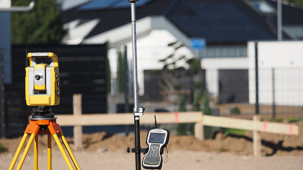
The fact is though, that fundamental changes are occurring, which pose critical challenges to Nigerian professionals. Technological innovation is blurring lines of demarcation between disciplines: And, in doing so, creating a need for new synergies and broader collaboration.
This thematic leitmotif, characterised the 3rd Annual Conference of the National Association of Surveying and Geoinformatics Lecturers (NASGL), held recently at the National Space Research and Development Agency (NASRDA) headquarters, in Abuja.
[ad]
Formally opening the four-day conference, Dr. Ahmad Halilu Shaba, NASRDA’s Director General, described the changes as a “paradigm shift” that has “repositioned” Surveying and Geoinformatics, from (often) obscure and esoteric disciplines, to mainstream operations.
The onus rests on scholars, educators and researchers — “Brainboxes,” as he termed them—not only to meet the challenge of change, but also to take advantage of the New Paradigm, and make a “remarkable contribution” to sustainable growth and development in Nigeria.
By way of explication, Professor Babatunde Rabiu, Director, of NASRDA’s Centre for Atmospheric Research, at Anyigba, Kogi State, defines “surveying” as the measurement and recording of the shape, size and spatial position of surface features, for map-making.
Meanwhile, he continues, “Geoinformatics,” involves measuring, storing, organising and analysing data, pertaining to Earth’s surface. Its branches are Cartography, Geodesy, Geographic Information Systems (GIS), Global Navigation Satellite Systems (GNSS), Photogrammetry, Remote Sensing and Web Mapping.
According to Rabiu, Surveying is a long-established profession. “For hundreds of years,” he notes, “surveyors used only a compass, chains and the plumb bob for mapping. The first great advance came with the invention of photogrammetry — the use of visual images, for making maps” — in 1850.
Analog photogrammetry reigned from around 1900, until 1960, Rabiu recounts, as the dominant topographic mapping technology. It was with the onset of the Space Age, and the advent of orbiting satellites, that analytical photogrammetry emerged as a major topographical system.
Starting with Prof. Lazarus Mustapha Ojigi, the outgoing chairman of NASGL, a succession of “Brainboxes” explored and expanded on Shaba’s “paradigm shift” motif — providing, in the process, varying degrees of detail and insight.
In his “welcome address,” for instance, Ojigi noted that the conference theme – “Innovations in Surveying and Mapping Technologies for Earth Systems and Resource Monitoring and Management” — was “carefully selected”.
What the organisers set out to achieve, with this theme, he explained, was “to amplify the growing technological evolutions in surveying and mapping for physical and scientific studies of the earth systems, features and processes.”
Nowadays, he stressed, all branches of modern surveying and geoinformatics are interlaced with components of other related professions. Hence the paradigm shift “is now towards earth data integration for mutli-disciplinary collaboration and interoperation.”
[ad]
Locally, this rules out what he called a ‘race of competition’ within the profession. Specifically, Ojigi said, NASGL “wishes to promote cooperation and collaboration” with the Nigerian Institution of Surveyors (NIS) – the parent body of all associations of surveying and geoinformatics in the country.
Professor Oliver C. Ojinnaka, from the Department of Geoinformatics and Surveying, University of Nigeria also cited Nigeria’s “Blue Economy,” as a case in point, noting that about 80 per cent of the world’s wealth, “either lie beneath the waters or are transported by sea”.
Referring, in his keynote address, to conflict between disciplines, over “the proposed Nigerian Hydrographic Office,” Ojinnaka too, emphasised the need for professional synergy “in the activities of the different specialties towards extracting this hidden wealth.”
In the initial proposal to the National Assembly, he said proponents of the Hydrographic Office suggested “Hydrography,” “Survey operations,” “Cartography,” “Aerial Survey,” “Cadastral Survey,” “Photogrammetry” and “GIS” as components.
But, “ironically,” he lamented, “Geodesy which has been known as the bedrock of surveying was omitted in the race to push forward the importance of the various specialties…” These kinds of lapses, Ojinnaka urged, ought to be avoided, at all cost.
Fortunately, though, “the said proposal was reviewed and a result-oriented division of the hydrographic office was articulated and tendered to the National Assembly for deliberations.” The seven new synergistic categories are, he believes, more compatible with the paradigm shift.
Interfaces and operations in five zones, reportedly highlight “the eroding boundaries between various aspects of surveying and confirms the need for synergy and collaboration.” These are land-marine, tidal/non-tidal and air-water interfaces, plus on-shore and off-shore operations.
“If we must achieve set goals in research, Ojinnaka advised, there must be deliberate effort to work as a team where the expertise of each individual (in all areas of specialisation) will be properly harnessed.”
Professor K. O. Oledare, the incoming Vice Chairman agrees. In a telephone interview with The Guardian, he said, “Over the next three years, NASGL will intensify its effort to reorient research practices and instructional programmes in Nigeria to the new professional paradigm.”
With jurisdictional boundaries increasingly blurred, he insists, Surveying and Geoinformatics professionals must “evolve away from exclusivist conceptions, in designing proposals and embarking on new projects. They should take all affected disciplines into account.”
Elaborating, in a separate interview, NASGL’s new Chairman, Professor Y. D. Opaluwa, of the Federal University of Technology, Minna, intimated that one objective, under his leadership, would be to up the tempo, activity-wise, and raise the level of awareness in Nigeria.
This entails not only preaching the New Paradigm gospel, but also becoming an aggressive advocate and a vocal exponent of issues, projects and programmes in which Surveying and Geoinformatics cohorts have a professional interest.
Opaluwa averred that NASGL would give ample attention to the hydrography service agency, including the issues Ajinnaka raised — as well as follow-up on its Oyo communique of 2020, calling for government, at all levels, to regulate land use in the country.
He believes the land use decree needs to be revised to accommodate developmental goals, which cannot be reached, as long as the present trend of unregulated wastage continues unabated.
[ad]
The chairman also looks forward to a heightened synergy with NASRDA, which hosted the conference. “There are many areas of possible collaboration,” he surmised, “such as mapping, land use studies and remote sensing. We’ll simply have to decide on our priorities.”
Shaba too referenced an array of synergistic disciplines (including “Geodesy,” “Remote Sensing” and “Mapping”), when declaring the meeting open, indicating, it appears, a natural affinity between the “Brainboxes” and NASRDA.
But in Rabiu’s estimation, more needs to be done, not only to enhance this affinity but also to cultivate a broader public appreciation of NASGL’s work, in particular, and Surveying/Geoinformatics generally.
He recommended, for instance, that the “communique from this conference be made available to relevant MDAs, higher education regulatory bodies, such as the National University Commission and the National Board for Technical Education,” along with policy makers.
Rabiu continued: “There should be a review of surveying curriculums in existing institutions of higher education, to account for continuing innovations — and even organisation of refresher training/workshops for members of this association…”
Echoing Shaba’s assertion that “emerging trends” call for “the right quantity and quality of lecturers/researchers” (“Brainboxes, if you will!), Rabiu urged NASGL to “float an institute, which would update and certify Nigerians, as Surveying and Geoinformatics innovations evolve.”
[ad]

