 Follow Us on Google News
 Follow Us on Google Discover
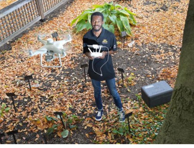
Ismail Olaniyi, a doctoral researcher at Purdue University’s Geospatial Data Science Laboratory, is at the helm of developing a pioneering approach to tackle citrus greening disease—a relentless threat to the global citrus industry.
Despite overcoming a challenging academic journey, Olaniyi’s innovative work is now drawing widespread attention. His research, which blends cutting-edge geospatial data science, remote sensing technology, and precision agriculture, is poised to revolutionize how U.S. farmers monitor and manage citrus crops. By harnessing unmanned aerial systems (UAS) and advanced machine learning techniques, he has developed models that can accurately estimate in-season crop yields, predict biomass, and assess weather impacts on agricultural productivity.
In a recent study conducted at Texas’s Weslaco Citrus Center, Olaniyi and a team of scientists introduced a non-invasive method to assess the severity of Huanglongbing (HLB)—commonly known as citrus greening disease. The study, titled “Assessing Huanglongbing Severity and Canopy Parameters of the Huanglongbing-Affected Citrus in Texas Using Unmanned Aerial System-Based Remote Sensing and Machine Learning,” showcased how UAS-derived data and AI algorithms can differentiate disease severity and monitor tree canopy health over two growing seasons.
With no known cure for HLB, this breakthrough research comes at a critical time for the citrus industry. The study also evaluated the impact of oxytetracycline (OTC) treatments—a method recently approved under a special local need label by the U.S. government—to manage the disease. By integrating key remote sensing indices, such as the red-edge chlorophyll index and canopy cover, with textural features, the research delivers an unprecedented level of precision in disease classification.
“The ability to remotely monitor and assess the health of citrus orchards without physical contact is a game changer,” said Olaniyi. “Our findings not only open new avenues for real- time disease management but also have broader implications for food security.”
The potential of Olaniyi’s breakthrough extends beyond the United States. By providing a scalable, non-destructive solution to evaluate HLB, the research may soon empower citrus growers globally. Future collaborations with software developers are expected to transform these scientific findings into user-friendly geospatial tools, giving farmers immediate insights into the health of their orchards.
As citrus growers worldwide struggle against the persistent threat of citrus greening disease, Olaniyi’s work stands as a beacon of hope. His innovative methods are not only setting a new standard in the field of agricultural remote sensing but also emphasizing the critical role of technology in securing the world’s food supply.
In related news, an article by Lindsey Berebitsky in Purdue University’s Agricultural Communications Department, titled “The Crossroads Between Lemon Trees and Technology,” highlights Olaniyi’s work on a UAV-based yield-estimation model for individual citrus trees. This model captures spatial data on tree health and treatment outcomes, showcasing further applications for both research and agricultural practice. The global food industry continues to grapple with the challenges posed by HLB (citrus greening disease), researchers like Ismail Olaniyi remind us that innovative solutions often lie beyond traditional methods. By leveraging remote sensing technologies, they are uncovering new ways to understand and address the complexities of nature, offering promising avenues to tackle the world food crisis.
[ad]

