 Follow Us on Google News



 Follow Us on Google Discover
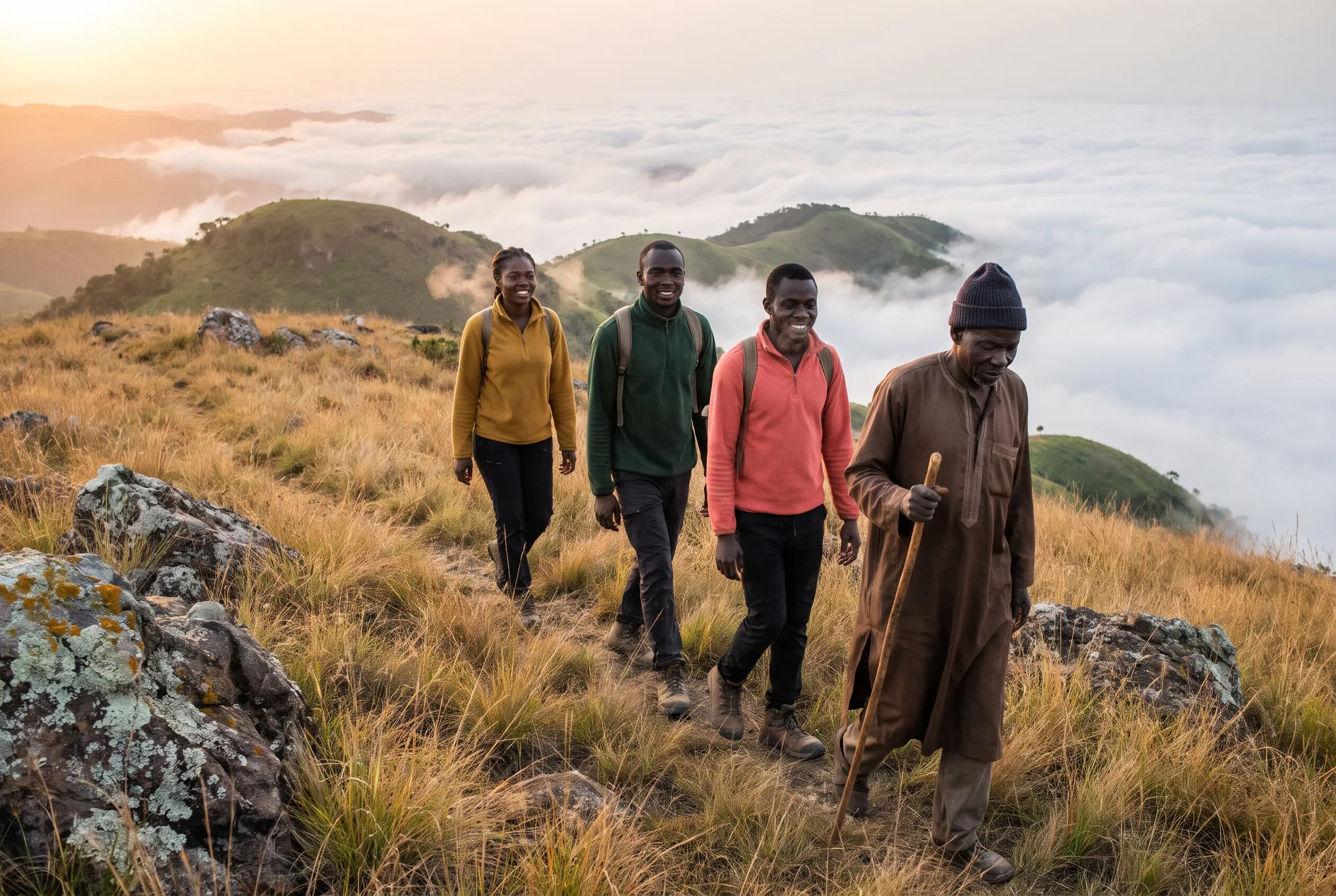
Welcome, and thank you for joining me on what is, quite literally, the high point of my writing year. This piece is the conclusion of months of research and years of experience hiking and questioning park rangers and old men in Gembu who know their hills better than any map.
So, what is the tallest mountain in Nigeria? Most of us heard the name once in a geography lesson and promptly forgot it before WAEC. The answer sits in the cool, rolling highlands of south-eastern Taraba, right on the border with Cameroon, and it is a far stranger, wilder and more rewarding place than the textbook ever let on.
I first went looking for it out of plain stubbornness. A friend in Ibadan had insisted, over a plate of amala at a buka near Dugbe, that Nigeria’s highest point was on the Jos Plateau. I was fairly sure he was wrong (I was right, for once), but I realised I could not tell him exactly where the real summit was, how high it stood, or whether anyone could actually walk up it.
That conversation started a long detour.
In this guide I will take you through the state that holds the summit, how many mountains Nigeria really has, the straight answer to the big question, a full top ten with measurements, a practical seven-step plan for climbing it, and how our highest peak compares with the giants of East Africa. Pour yourself a cup of Highland tea (you will understand that reference shortly) and let us begin.
Which Nigerian State Is Home to the Highest Mountain?
Taraba State is home to the highest mountain in Nigeria.

That surprises a lot of people from the South West and the South East, who tend to picture the North East as flat Sahel country. Parts of it are. But Taraba’s southern and eastern edge rises like a wall, climbing from hot river valleys along the Benue and Donga into a band of grassy uplands, forested escarpments and rocky summits that feel more like the Scottish Highlands than anything a Lagosian would recognise as Nigeria.
The state’s own overview of Taraba’s natural attractions leans heavily on two names: the Mambilla Plateau and Gashaka-Gumti National Park. Those are the two places you need to understand, because the summit sits exactly where they meet. The state government describes Taraba as covering 54,473 square kilometres, with a population of roughly 4.1 million people, which makes it one of the larger states in the federation by land area and one of the less crowded.
The Mambilla Plateau
Think of the Mambilla Plateau as a giant raised table. It averages about 1,600 metres above sea level, stretches roughly 96 kilometres along its curved length and about 40 kilometres across, and is bounded in places by escarpments around 900 metres high. In total the highland covers more than 9,000 square kilometres, which is bigger than Lagos State several times over.
Up there, everything changes. The air is thinner and cooler, mosquitoes are noticeably scarcer, and the hillsides are stitched with tea bushes. If you have ever drunk Nigerian-grown tea, there is a good chance the leaves came from the estates around Kakara near Gembu, the plateau’s main town.
I remember my first evening in Gembu very clearly. I had arrived in a short-sleeved shirt, full of Lagos confidence, and by eight o’clock I was sitting by a charcoal stove wrapped in a borrowed blanket, drinking tea so strong it could have stood up on its own. A woman selling roasted plantain by the roadside laughed at me (kindly, I think) and told me I had “brought the wrong weather”.
She was right. Night temperatures on the plateau regularly fall to around 12°C during harmattan, and lower still on the exposed ridges. (If you want the national record books, I have written separately about the coldest temperature ever measured in the country.)
Gashaka-Gumti National Park
Just north of the plateau lies Gashaka-Gumti National Park, the largest national park in Nigeria. According to the Bureau of Public Enterprises’ concession notice for the park’s eco-tourism lodges, the park covers about 6,731 square kilometres, was created by Federal Government Decree No. 36 of 1991 by merging the Gashaka and Gumti game reserves, and holds the largest remaining population of the endangered Nigeria-Cameroon chimpanzee. The same notice sets out the government’s ambition to bring in a private operator to build and run at least 300 beds of eco-lodge and hostel accommodation over a thirty-year concession.
That matters for anyone dreaming of the summit, because accommodation near the park has always been basic.
The park itself is enormous and wildly varied. Its northern Gumti sector, in Adamawa State, is largely flat woodland and savannah. Its southern Gashaka sector, in Taraba, is where the drama happens: steep forested slopes, deep valleys, fast rivers and, at the very top, the montane grassland of Nigeria’s highest summit. Altitude inside the park runs from roughly 450 metres in the north to around 2,400 metres in the south, a range of almost two kilometres within one protected area.
Getting There Is Becoming Easier
Here is the honest truth about the region: distance has always been its biggest obstacle. The usual route has been a flight from Lagos or Abuja to Yola or Jalingo, followed by many hours on winding roads through Serti and Nguroje before the long climb up to Gembu.
There is movement on that front. In July 2026 the Federal Information Centre in Jalingo reported that the President had approved immediate construction of an airstrip on the Mambilla Plateau, with engineers and contractors already inspecting the proposed site. If it is built as described, a journey that currently eats up the better part of two days could shrink dramatically.
Would that change the character of the place? Probably a little. Rather like the opening of a new expressway into a quiet village, it would bring visitors, money and, inevitably, more noise. I suspect the people of Gembu will welcome the money and grumble about the noise, which is a very Nigerian way of handling progress.
How Many Mountains Are There in Nigeria, and Where Are They?
There is no single official count, and anyone who quotes you one with total confidence is guessing.
The difficulty is definitional. What separates a mountain from a hill, or a hill from a large rock? In Nigeria the line is blurry, because so much of our high ground takes the form of inselbergs: isolated granite domes that burst out of flat country, like Zuma Rock near Madalla or Olumo Rock in Abeokuta. Geologists treat them differently from true mountain ranges, but every Nigerian child calls them mountains, and I am not about to argue with that.
The best working figure comes from peak databases. PeakVisor, which catalogues named summits worldwide, lists 2,076 named mountains in Nigeria. That number includes a great many modest hills, but it gives you a sense of scale. We are not a flat country, whatever the stereotype says.
Nigeria’s Main Highland Regions
Most of the high ground clusters along the eastern border with Cameroon, with a second important block in the centre of the country.
The Mambilla and Gotel highlands (Taraba). The tallest and wildest of all, including Chappal Waddi and dozens of summits above 1,500 metres. This region is the northern continuation of the Bamenda Highlands of Cameroon.
The Shebshi Mountains (Adamawa). A range running roughly 160 kilometres between the Benue and Taraba rivers, crowned by Mount Dimlang.
The Alantika and Mandara Mountains (Adamawa and Borno). Rugged, rocky ranges along the border, home to the Sukur cultural landscape, whose terraced hillsides and stone architecture are recognised by UNESCO.
The Jos Plateau (Plateau State). A high tableland averaging around 1,200 metres, with the Shere Hills east of Jos city rising to about 1,829 metres.
The Obudu Plateau and Sankwala Mountains (Cross River). Home to the famous Obudu Mountain Resort, perched at about 1,576 metres on the Oshie Ridge.
The south-western hills (Ondo, Ekiti, Ogun, Osun). Lower but beautiful, including the Idanre Hills, the Ikogosi area and countless granite outcrops.
What Highland Living Teaches You About Design
One thing I find fascinating is how altitude shapes the way people build. On the Mambilla Plateau and around Jos, older homes often have thicker walls, smaller windows and a hearth or cooking space placed to warm the main room, which is the opposite of the tall, open, cross-ventilated designs you see in Calabar or Lagos. Rather like layering clothes, a highland home is built to hold heat in, not let it out.
If you are visiting, take a design lesson from the locals. Bring a warm wrapper or a light shawl even if the afternoon is sunny, choose accommodation with solid walls rather than a breezy chalet if you feel the cold, and keep a flask of something hot by the bed. It sounds dramatic for Nigeria. It is not, once you have spent a December night at 1,800 metres.
The Straight Answer: What Is the Tallest Mountain in Nigeria?
The tallest mountain in Nigeria is Chappal Waddi, which stands at 2,419 metres (7,936 feet) above sea level on the border between Taraba State and Cameroon, at the edge of Gashaka-Gumti National Park and the Mambilla Plateau. It is also known as Gangirwal, a name usually translated as “the mountain of death”, and its older indigenous name among the Mambilla people is Gang, or Gang Peak. It forms part of the Bamenda, Alantika and Mandara mountain chain that runs along the Nigeria-Cameroon frontier, it has a topographic prominence of about 1,165 metres, and by most definitions it is also the highest point in West Africa. Some peak databases list it a couple of metres higher, at around 2,421 metres, but 2,419 metres is the figure used by most references and by the Nigerian sources I trust.
That is the answer to pin on your fridge.
Why “the mountain of death”? Nobody agrees entirely. Some say the name comes from the sudden, brutal weather on the summit, where cloud can swallow the ridge in minutes and temperatures drop sharply after dark. Others link it to the old Mambilla belief, recorded in local tradition, that the fortunes of each farming season (good harvests or poor ones) were decided up on Gang. Either way, it is a name that commands respect, and that is no bad thing for a mountain.
The summit itself is not a sharp spike. Researchers who have worked in the park describe a broad summit area of roughly 21 square kilometres covered in lichen-crusted rock, low shrubs, montane grassland and streamside woodland. Stand up there on a clear harmattan morning and you look down on a sea of cloud with Cameroon stretching away to the east. Rather like standing on the roof of a very tall house and realising the whole neighbourhood is beneath you, it rearranges your sense of where Nigeria actually is.
And here is a thought I return to often: on a clear night up there, you are higher than every one of the more than two hundred million Nigerians asleep below you.
Our colleagues at the Guardian’s Life desk captured this beautifully in a travel piece from Gembu on the road to the summit, which describes the plateau’s cold nights, its tea estates and its waterfalls with real affection. It is worth reading before you go.
What Are the Top 10 Highest Mountains in Nigeria?
Ranking Nigeria’s peaks is harder than it should be.
After the top three, the published figures start to wobble. Different databases measure from different survey data, several summits share the same opening word (Taraba has a whole family of peaks called Chappal something), and many of the mid-ranking summits are remote, rarely visited hills in the Gashaka and Mambilla country that have never had a proper ground survey. Some crowd-edited lists even place peaks in Niger State and Borno State above 2,200 metres, but I could not match either figure to any survey or peak database, and the Mandara range those Borno figures would sit in tops out at roughly 1,500 metres. I have left them out.
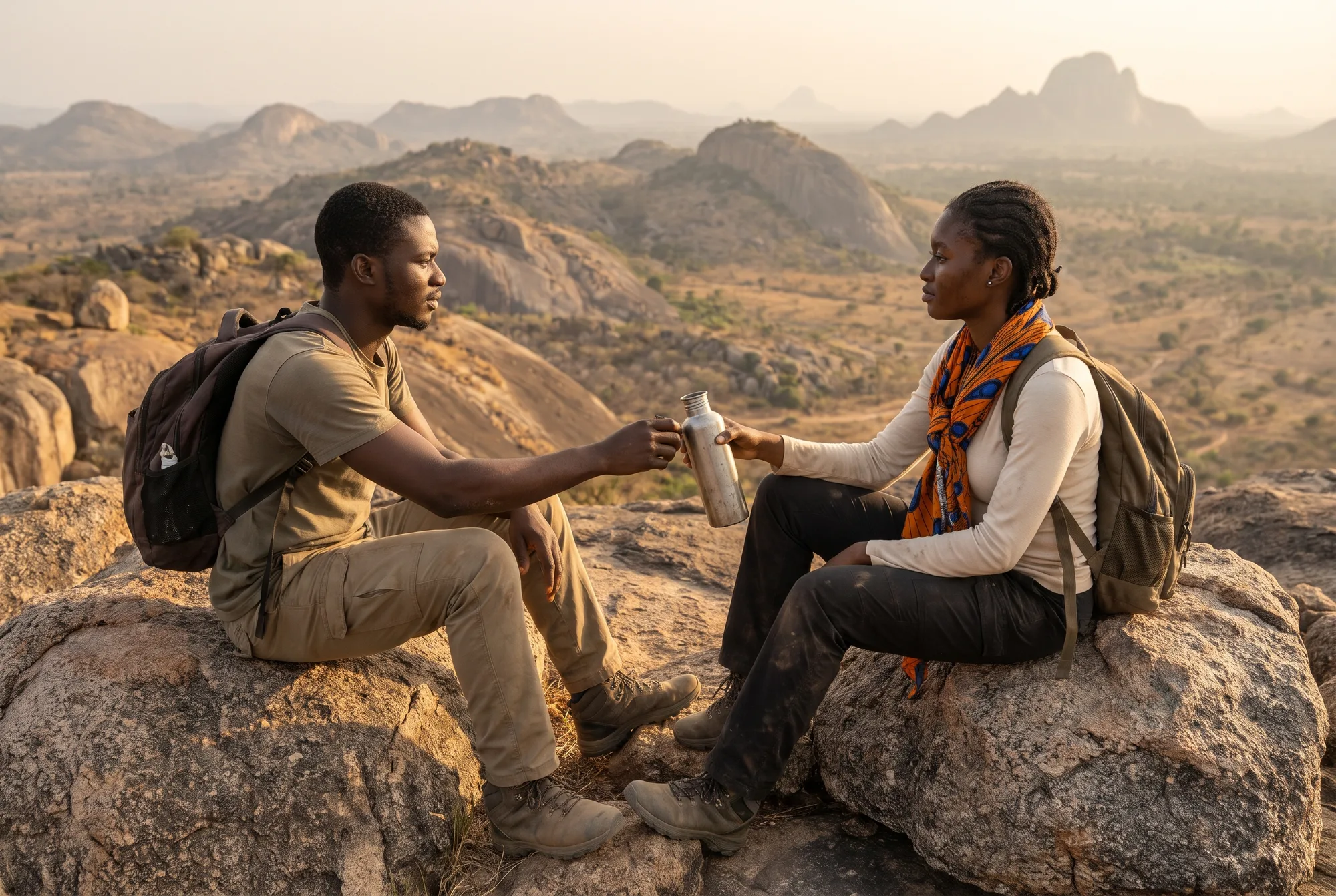
What follows is the ranking I am confident enough to put my name to, built from peak databases, park research and Nigerian travel sources. Treat the heights below the top three as accurate to within a few dozen metres.
Nigeria’s Highest Mountains Ranked by Height and Location
| Rank | Mountain | Height (m) | Height (ft) | State | Range or area | Can visitors climb it? |
|---|---|---|---|---|---|---|
| 1 | Chappal Waddi (Gangirwal) | 2,419 | 7,936 | Taraba | Mambilla highlands, Gashaka-Gumti National Park | Yes, with park permission and a guide |
| 2 | Mount Dimlang (Vogel Peak) | 2,042 | 6,699 | Adamawa | Shebshi Mountains | Yes, remote, local guide essential |
| 3 | Shere Hills high point | 1,829 | 6,001 | Plateau | Jos Plateau, east of Jos | Yes, the most accessible of the top three |
| 4 | Sankwala Mountains high point | about 1,800 | about 5,906 | Cross River | Obudu Plateau | Partly, via Obudu Mountain Resort trails |
| 5 | Tchangue | about 1,783 | about 5,850 | Taraba | Gashaka uplands | Rarely visited |
| 6 | Chappal Hendu | about 1,759 | about 5,771 | Taraba | North of the Mambilla Plateau | Rarely visited, research access |
| 7 | Danko Hill | about 1,743 | about 5,719 | Taraba | Gashaka uplands | Rarely visited |
| 8 | Kafasiradi Hill | about 1,733 | about 5,686 | Taraba | Gashaka uplands | Rarely visited |
| 9 | Shebo Hill | about 1,703 | about 5,587 | Taraba | Gashaka uplands | Rarely visited |
| 10 | Lugadorena Hill | about 1,679 | about 5,509 | Taraba | Gashaka uplands | Rarely visited |
The pattern is hard to miss: seven of the ten highest summits are in Taraba, and the only three outside it sit in Adamawa, Plateau and Cross River, all of them close to the eastern highland belt. If you want to see Nigeria’s high country without a week-long expedition, the Shere Hills near Jos and the Obudu Plateau are your realistic weekend options.
The Second Highest Mountain in Nigeria
Mount Dimlang deserves a moment of its own, because it is the answer to a question I get asked constantly. At 2,042 metres it rises from the Shebshi Mountains in southern Adamawa, close to Ganye and Jada. It was once called Vogel Peak, after the German explorer Eduard Vogel, who travelled through the region in the 1850s, and it is a proper climb: long, hot on the lower slopes and cool near the top.
Where Chappal Waddi feels like a highland walk across grassland, Dimlang feels like a mountain in the classic sense, rising steeply out of the plain. Rather like comparing a tall plateau farmhouse with a church spire, one is big and broad, the other narrow and dramatic.
The Easiest High Country to Reach
The Obudu Plateau deserves a special mention for families and first-timers. You reach the resort by an 11-kilometre road with famously tight hairpins (the bend known as the Devil’s Elbow will test your stomach), and once there the cable car, canopy walk and cool air make it the gentlest introduction to Nigerian altitude. A first-hand Guardian Life account of a visit to the resort captures the mix of nerves and delight that drive produces rather well.
How to Climb Chappal Waddi: Seven Steps From Planning to Summit
Can an ordinary, reasonably fit Nigerian climb the tallest mountain in the country? Yes. Should you treat it like a stroll to the shops? Absolutely not.
This is a remote, expedition-style trip into a national park on an international border, and the planning matters more than the climbing. Here is the process I recommend, based on my own trips into the highlands and long conversations with people who have reached the top.
- Choose your season carefully. Aim for the dry harmattan months, from roughly November to February, when paths are firm, rivers are low and the summit views are clearest. During the rains from about May to October the trails turn to slippery red mud, river crossings swell and cloud can hide the summit for days, so even experienced hikers usually avoid that window.
- Plan your route in and budget for it properly. Most visitors fly from Lagos or Abuja to Yola or Jalingo, then travel by road through Jalingo and Serti towards the park, a journey that can take a full day on its own. At the time of writing, budget roughly ₦180,000 to ₦300,000 for a one-way ticket with an Abuja connection, plus ₦60,000 to ₦120,000 for a hired car and driver each day, and expect fuel prices in the region to run higher than in the south.
- Report to the park first and hire a guide. Begin at the Gashaka-Gumti National Park office at Serti to register, pay any entry or camping fees and arrange an official guide or ranger. Expect to pay in the region of ₦15,000 to ₦30,000 a day for a guide and ₦10,000 to ₦20,000 a day for each porter, and agree the total in advance, in writing if possible.
- Check security before every leg of the journey. Parts of Taraba and Adamawa have seen kidnappings and farmer-herder clashes in recent years, so speak to the park authorities, your hotel and local contacts in Jalingo or Gembu before setting off, and never travel the remote roads after dark. Share your itinerary with someone at home and agree a daily check-in time.
- Train for the climb, not just the walk. The ascent from the village of Jauro Hammasale gains well over a thousand metres of height, so in the six to eight weeks beforehand practise climbing stairs or hills with an 8 to 10 kilogram backpack. A useful benchmark is being able to climb 600 vertical metres in under two hours without needing to stop for long.
- Pack for cold, wet and remote. Bring a warm fleece and a windproof jacket, because by my rough lapse-rate arithmetic summit nights in harmattan can fall into single figures, plus a waterproof layer, broken-in boots, a headtorch and a water filter or purification tablets. Carry at least three litres of water per person per day, high-energy food such as groundnuts, dates and dried mango, and a basic first aid kit with blister plasters.
- Respect the people and the park. Ask before photographing anyone in the villages, pay porters and guides fairly and on time, carry out every scrap of rubbish, and stay on established paths to protect the fragile montane grassland. The communities around the park have lived with this mountain for generations, and the best part of the trip is often the conversation you have with them on the way down.
Styling Tips for the Summit (Yes, Really)
Let me be a little playful for a moment, because people always ask me what to wear.
Layers are everything. A thin moisture-wicking base, a fleece and a light shell will carry you from a 30°C valley morning to a chilly summit evening without carrying a wardrobe. Choose bright colours for at least one layer (a mustard, a coral or a classic Super Eagles green) because they stand out against the golden harmattan grass in photographs and make you easier to spot if you wander off the path.
A cotton buff or a folded ankara scarf earns its place too. It keeps dust off your face on the drive in, warms your neck at the summit and, frankly, makes your summit photos look far better than a plain fleece ever will. You can pick up a decent pair of hiking boots in Lagos markets such as Tejuosho or Yaba for roughly ₦35,000 to ₦80,000, but break them in for at least a fortnight before you go.
How Does Nigeria’s Highest Peak Compare With the 2nd Highest Mountain in Africa?
Now for some perspective, and perhaps a small dose of humility.
The second highest mountain in Africa is Mount Kenya, whose highest summit, Batian, reaches 5,199 metres. That is 2,780 metres taller than Chappal Waddi, which means you could stack our highest peak on top of itself and still not quite reach Batian’s summit. Above Mount Kenya sits only Kilimanjaro in Tanzania, at 5,895 metres, the roof of the continent. The Rwenzori’s Mount Stanley, on the border of Uganda and the Democratic Republic of Congo, comes in third at 5,109 metres.
Chappal Waddi, by comparison, is about 41 per cent of the height of Kilimanjaro.
Should that make us feel small? Not at all. East Africa’s giants are volcanoes and uplifted blocks shaped by the Great Rift system, a completely different kind of geology. Comparing them with Nigeria’s ancient worn-down highlands is rather like comparing a skyscraper with a centuries-old cathedral: one is taller, the other has simply been standing a great deal longer.
Where Chappal Waddi Ranks in West Africa
Closer to home, the picture flips entirely.
Under the most common definition of West Africa (the United Nations’ sixteen-country grouping, which runs from Mauritania and Senegal to Niger and Nigeria), Chappal Waddi is the highest point in the region. Sierra Leone’s Mount Bintumani reaches about 1,945 metres, Mount Nimba on the Guinea and Côte d’Ivoire border about 1,752 metres, and Ghana’s Mount Afadjato only around 885 metres, which gives Nigerians one more thing to tease our Ghanaian friends about (as if we needed another).
Our northern neighbour is closer. Niger’s highest summit, Mont Idoukal-n-Taghès in the Aïr Mountains, stands at about 2,022 metres, so Chappal Waddi beats it by roughly 400 metres. If you are curious about how the two countries ended up with such different landscapes and borders in the first place, my earlier piece on why Niger and Nigeria went their separate ways covers that history.
The obvious rival is Mount Cameroon, an active volcano rising to about 4,040 metres just across our eastern border. It is much taller than Chappal Waddi, but Cameroon is usually classed as part of Central Africa rather than West Africa, which is why our summit keeps the regional title.
What This Means for Nigerian Climbers
Here is my practical takeaway from all these numbers. Chappal Waddi makes a superb training ground for Nigerians who dream of Kilimanjaro or Mount Kenya one day.
It teaches you long days on foot, cold nights, remote logistics and the discipline of carrying what you need. It will not teach you how your body copes with serious altitude, because 2,419 metres is still below the height where altitude sickness usually becomes a real concern, but it will tell you very quickly whether you enjoy mountain life at all. And it costs a fraction of a Tanzanian expedition, which, with the naira where it is, matters a great deal.
The Guardian’s Life desk also published a road-trip guide through Jalingo, Serti and Gembu, which is a useful companion if you would rather see the highlands from the road before committing to a full climb.
Final Thoughts on the Tallest Mountain in Nigeria
Chappal Waddi is a mountain most Nigerians will never see, and that is a shame. It sits at 2,419 metres on the edge of our largest national park, it holds the title of West Africa’s highest point, and it is surrounded by a highland world of tea estates, cold nights, chimpanzee forests and communities with their own deep stories about the summit.
We have covered why Taraba holds the crown, how Nigeria’s 2,000-plus named peaks are spread across the eastern highlands and the central plateau, the full top ten, a practical route to the summit and how our highest point measures up against Africa’s giants. If you take one thing away, let it be this: Nigeria’s high country is real, it is reachable, and it is changing, with a new airstrip approved and eco-lodges planned.
So where should you start? Here are three gentle next steps.
- Settle the next geography argument at a family gathering with the right name and height, and then suggest a group trip instead of a debate.
- Try a weekend at the Shere Hills or the Obudu Plateau first, to see how you and your knees feel about Nigerian altitude before committing to Taraba.
- Follow news on the Mambilla airstrip and the Gashaka-Gumti lodge concession, because either one opening could cut your travel time and costs considerably.
Related Articles
If the cold nights on the plateau caught your attention, you will enjoy my investigation into whether it ever snows in Nigeria, which looks at frost, hail and the surprisingly chilly mornings on our highest ground. And if you are deciding where to feel that chill without a full expedition, my guide to the states where Nigeria gets genuinely cold compares Plateau, Taraba and the other highland states season by season.
Key Takeaways
- Remember the name, the height and the place: Chappal Waddi, 2,419 metres, on the Taraba border with Cameroon.
- Keep Mount Dimlang in Adamawa, at 2,042 metres, on your list as the second highest peak and a quieter alternative climb.
- Treat rankings below the top three with caution, since many Taraba summits have never been properly surveyed.
Frequently Asked Questions About the Tallest Mountain in Nigeria
What is the tallest mountain in Nigeria?
The tallest mountain in Nigeria is Chappal Waddi, also called Gangirwal, which rises to 2,419 metres or 7,936 feet above sea level. It stands on the Taraba State border with Cameroon, at the edge of Gashaka-Gumti National Park.
Where is the tallest mountain in Nigeria located?
Chappal Waddi is located in south-eastern Taraba State, where the Mambilla Plateau meets the southern Gashaka sector of Gashaka-Gumti National Park. The summit lies directly on the international border with Cameroon.
Why is Chappal Waddi called the mountain of death?
Gangirwal, its other common name, is usually translated as the mountain of death, a reference often linked to its sudden storms, cloud and cold nights. Local Mambilla tradition also holds that the fortunes of each farming season were decided on the mountain, which they call Gang.
Which state in Nigeria has the highest mountain?
Taraba State has the highest mountain in Nigeria, along with most of the country’s other high summits. Seven of the ten highest peaks in Nigeria lie within Taraba, mostly in the Gashaka and Mambilla uplands.
How many mountains are there in Nigeria?
There is no official count, but the peak database PeakVisor lists 2,076 named mountains in Nigeria. That figure includes many small hills and granite inselbergs such as Zuma Rock and Olumo Rock alongside true highland summits.
What is the second highest mountain in Nigeria?
Mount Dimlang, once known as Vogel Peak, is the second highest mountain in Nigeria at 2,042 metres. It rises from the Shebshi Mountains in southern Adamawa State, near Ganye and Jada.
Which is the 2nd highest mountain in Africa?
Mount Kenya is the second highest mountain in Africa, with its highest summit, Batian, reaching 5,199 metres. Only Kilimanjaro in Tanzania, at 5,895 metres, stands taller on the continent.
Is Chappal Waddi the highest mountain in West Africa?
Yes, Chappal Waddi is the highest point in West Africa under the usual United Nations definition of the region’s sixteen countries. Mount Cameroon is taller at about 4,040 metres, but Cameroon is normally classed as part of Central Africa.
Which mountain is the largest in Nigeria?
By height the largest mountain in Nigeria is Chappal Waddi, at 2,419 metres above sea level. By sheer area, the Mambilla Plateau highlands that carry it cover more than 9,000 square kilometres, making them the biggest single upland block in the country.
Can you climb Chappal Waddi?
Yes, Chappal Waddi can be climbed by reasonably fit hikers without technical mountaineering skills. You need permission from Gashaka-Gumti National Park, an official guide and careful security planning before setting off.
How long does it take to climb Chappal Waddi?
Most trips need at least four to six days in total once travel from Jalingo or Yola, park registration and the trek itself are included. The ascent from the village of Jauro Hammasale usually takes a long, full day on foot.
When is the best time to climb the tallest mountain in Nigeria?
The best time is the dry harmattan season from roughly November to February, when trails are firm and summit views are clearest. Avoid the rainy months from about May to October, when paths turn muddy and cloud often hides the peak.