GDN SIDEBAR
Landscapes are the natural scenery of a place, shaped by its landforms, vegetation, and climate. In Nigeria, this ranges from the open grasslands of the highlands to rocky outcrops and mountain ridges. From Taraba’s Mambilla Plateau to the granite peaks of Shere Hills in Plateau State, these five landscapes reveal the country’s beautiful terrains.
1. Mambilla Plateau, Taraba State
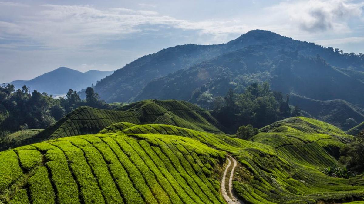
In southeastern Taraba State, the Mambilla Plateau stretches across rolling hills, open grasslands and steep slopes. At an average elevation of about 1,600 metres, it is considerably higher than much of Nigeria, giving it a cooler climate that supports farming and cattle rearing.
Around Gembu, one of the plateau’s principal towns, farms and settlements sit between the hills. Tea is also grown around Kakara, adding to the area’s agricultural character. The scenery changes from gently undulating grassland to ridges and escarpments that overlook the surrounding countryside.
Waterfalls are another feature of the plateau. Barup, Manchewa, Rufi, Tiba and Bambika are among those listed by Nigeria’s Federal Ministry of Information and National Orientation. Together, the highlands, waterways and farming communities give Mambilla a landscape distinct from Nigeria’s lowland regions.
2. Obudu Plateau, Cross River State

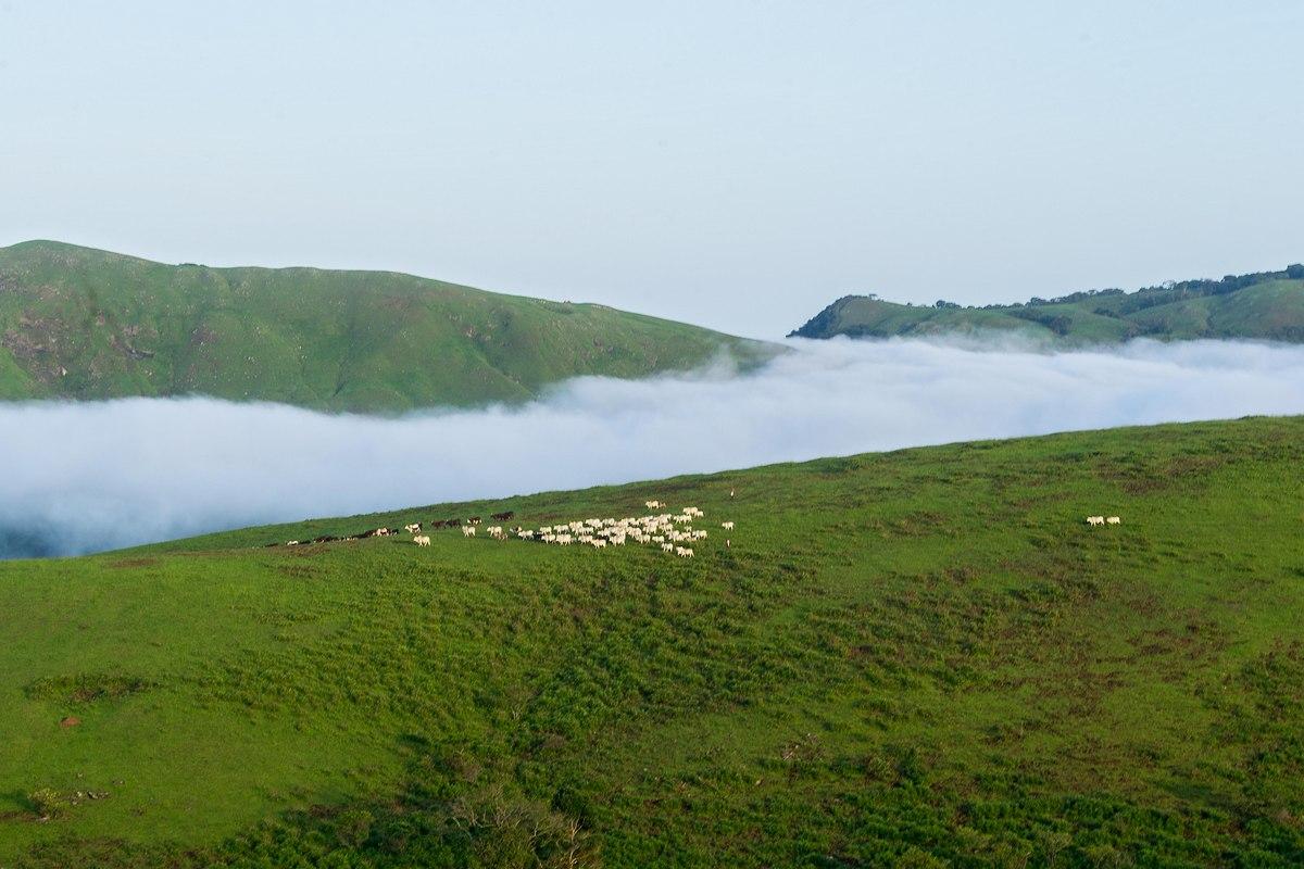
In northeastern Cross River State, the Obudu Plateau lies within the Sankwala Mountain region, close to the Cameroon border. Its elevation creates a cooler environment than the state’s lowlands, while its hills and valleys support a mix of grassland and wooded vegetation.
Obudu Mountain Resort is one of the area’s best-known landmarks, sitting high above the surrounding countryside. Beyond the resort, streams, wooded slopes and patches of montane vegetation add variety to the scenery. The contrast is striking in a state widely associated with tropical rainforest.
The mountains can look different from one day to the next. Cloud cover sometimes hides the ridges, while clearer conditions reveal the contours of the hills and the vegetation covering their slopes.
Obudu’s landscape is shaped by elevation, rainfall, and vegetation. Its combination of open highlands, green valleys and mountain scenery gives Cross River State a geographical character beyond its familiar forests.
3. Jos Plateau, Plateau State
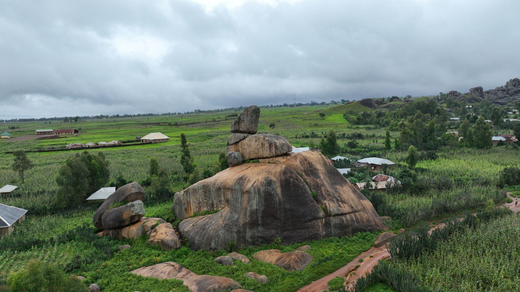
The Jos Plateau stands out for its rocky outcrops, rolling hills and unusual geological formations. Its landscape reflects a long history of geological activity, including the formation of granite and other igneous rocks, as well as volcanic activity.
Large rocks rise above grassland and farmland in some areas, while settlements and cultivated fields occupy the valleys and more accessible ground. This creates a landscape where natural formations and everyday rural life sit side by side.
The plateau contains older basement rocks alongside younger granite formations and volcanic rocks associated with Jurassic geological activity. Over time, weathering and erosion have helped shape the hills, valleys and exposed rock surfaces seen today.
Mining has also played a significant role in Plateau State’s history because of its mineral deposits. Yet the plateau’s importance extends beyond its resources. Its varied terrain offers a striking illustration of how geological processes have shaped Nigeria’s physical environment over millions of years.
4. Sukur Cultural Landscape, Adamawa State
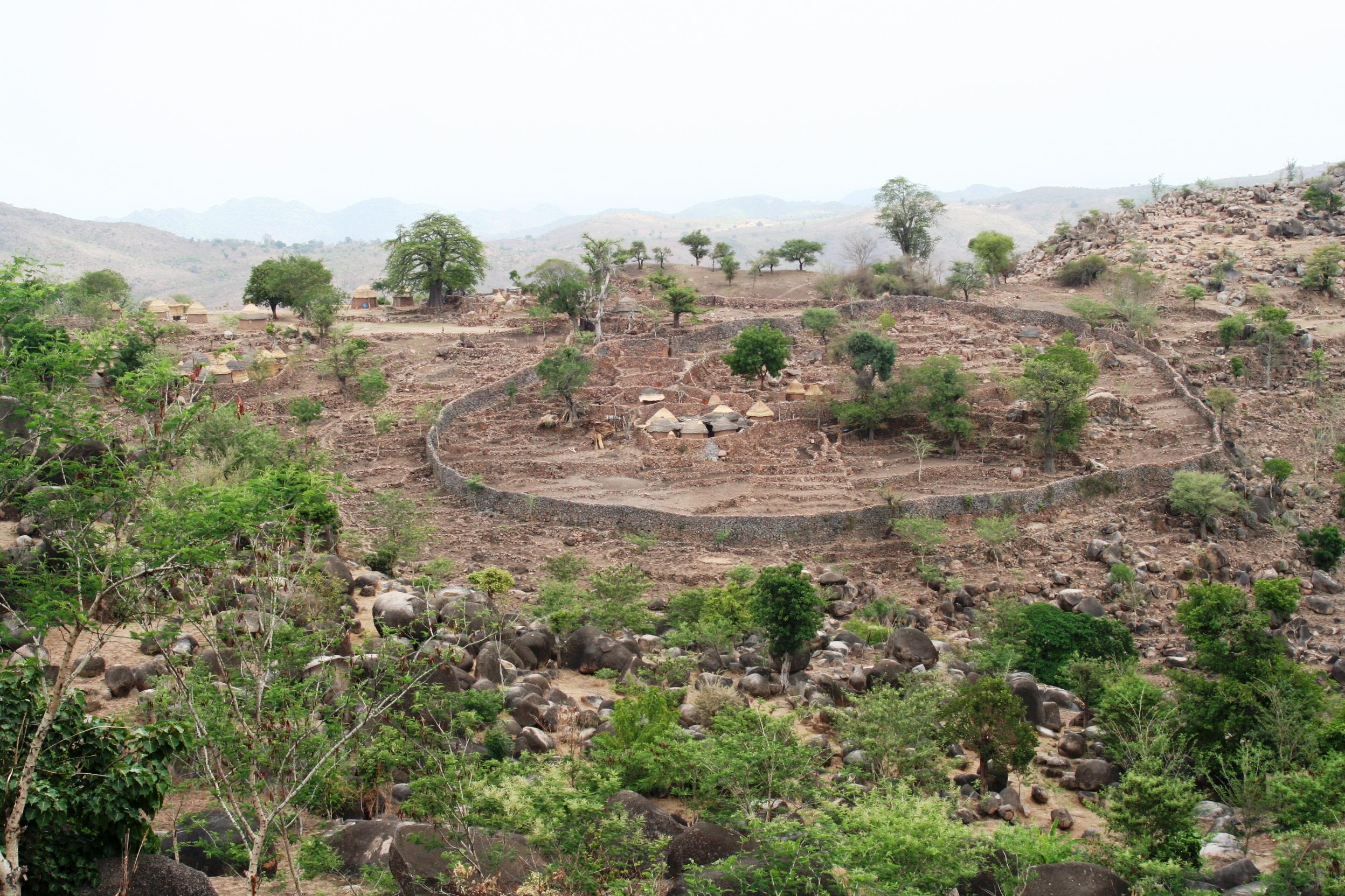
Set in the Mandara Mountains near Nigeria’s border with Cameroon, the Sukur Cultural Landscape shows how closely a community’s history can be tied to its surroundings.
Located in Madagali Local Government Area of Adamawa State, Sukur became a UNESCO World Heritage Site in 1999. Its defining features include the palace of the Hidi, the traditional ruler, terraced fields, stone-paved pathways and remains of an ironworking industry.
The terraces follow the slopes of the hills, reflecting generations of farming knowledge adapted to the mountainous terrain. Stone pathways link different parts of the settlement, while traditional buildings and dry-stone structures form part of the wider landscape.
Sukur is significant not only for its scenery but also for what it reveals about traditional governance, agriculture, ironworking and cultural life. Its palace, shrines, terraces and village structures show how people have shaped the land while adapting to its natural features.
5. Shere Hills, Plateau State
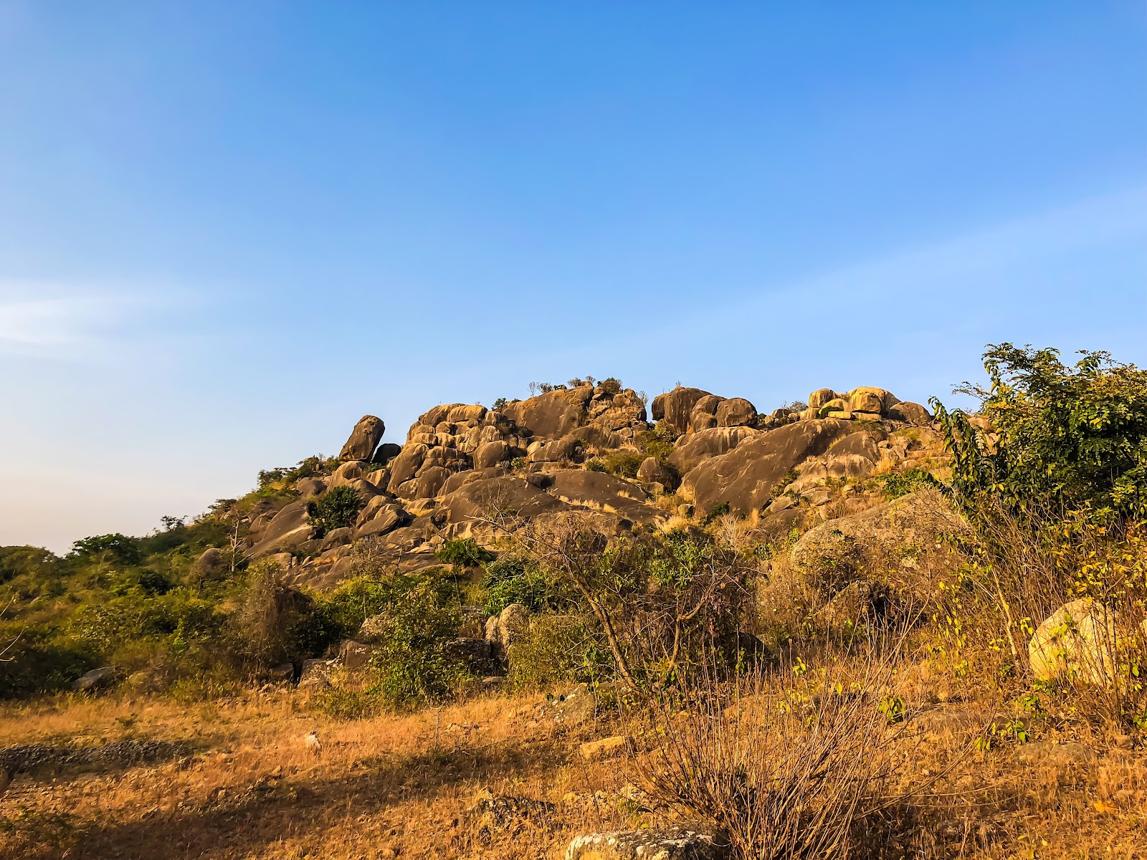
Near Jos, Shere Hills rises above the surrounding countryside in a series of rugged slopes and prominent rocky peaks. The hills form part of the wider Jos Plateau, a region known for its distinctive rock formations and elevated terrain.
Large exposed rocks give the hills much of their character, standing out against the surrounding grassland and valleys. From higher points, the landscape opens up across parts of Plateau State, revealing the uneven terrain that distinguishes the plateau from the lower ground around it.
However, Shere Hills has also faced pressure from mining and quarrying. In August 2026, Punch reported that mining activity had damaged parts of the hills, prompting concern about the condition of the natural landscape.
The issue highlights a difficult balance between mineral extraction and environmental preservation. Once rock formations are excavated, their original shapes and surrounding terrain can be permanently altered. Shere Hills therefore illustrates both the geological character of the Jos Plateau and the challenges involved in protecting Nigeria’s natural landscapes.