 Follow Us on Google News
 Follow Us on Google Discover
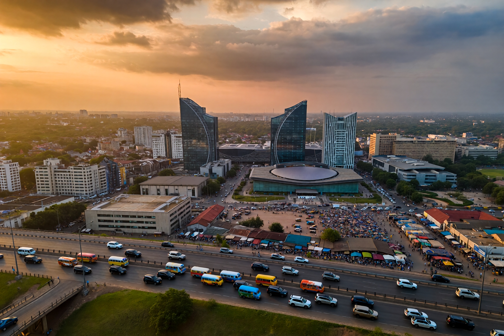
Welcome, dear readers! I’m absolutely delighted you’ve found your way to this comprehensive exploration of Nigeria’s geographical placement and what it means for our magnificent nation. This article represents the culmination of months of research into African geography, continental dynamics, and Nigeria’s unique position within the global landscape, drawing upon years of experience documenting African cultural and geographical contexts. After extensively researching Nigeria’s continental connections, consulting with geographers across our six geopolitical zones, and examining how our location shapes everything from climate to culture, I can provide you with a thorough understanding of not just where Nigeria sits on the world map, but why that location matters profoundly.
Let me start with the straightforward answer: Nigeria sits proudly on the African continent, specifically in West Africa along the Atlantic coast. But that simple geographical fact barely scratches the surface of what makes Nigeria’s continental positioning so fascinating and consequential for our nation’s development, cultural identity, and role in global affairs.
I still remember my first geography lesson in primary school in Lagos, when our teacher pointed to a massive wall map of Africa and asked us to find Nigeria. My finger traced the western bulge of the continent, eventually landing on that familiar shape we all know so well. What I didn’t understand then (but have come to appreciate deeply through years of research) is that Nigeria’s location within Africa isn’t just a random accident of geology and history. Our position has shaped who we are as a people, how we’ve developed economically, and the extraordinary influence we wield across the continent and beyond.
According to the Nigeria Geological Survey Agency, Nigeria’s geological formation reflects Africa’s ancient continental structure, with rock formations dating back hundreds of millions of years to when Africa was part of the supercontinent Gondwana. This deep geological heritage connects us fundamentally to the African landmass in ways that go far beyond modern political boundaries. The Nigerian Ministry of Foreign Affairs emphasises Nigeria’s role as “the gateway to Africa’s most populous nation,” recognising that our West African position makes us a bridge between the Sahel region to our north and the coastal Atlantic nations to our south.
Which Continent Are We Currently in as Nigerians?
This question might seem redundant after establishing that Nigeria sits in Africa, but it touches on something deeper about identity and continental belonging. As Nigerians in 2026, we are unquestionably African. That’s not just a geographical designation. It’s a fundamental aspect of our identity that shapes how we see ourselves and how the world sees us.
Nigeria represents Africa’s demographic giant, with our population comprising roughly 15 to 18 per cent of the entire African continent’s people. When you walk through the streets of Lagos, Kano, or Ibadan, you’re experiencing Africa at its most populous and dynamic. Our cultures, languages, and traditions are distinctively African whilst simultaneously being uniquely Nigerian.
The Federal Ministry of Education includes comprehensive geography curricula that teach Nigerian students about their place within the continent, covering the main geopolitical zones and physical features that define our country within the broader African context. This educational emphasis ensures young Nigerians understand both their national identity and their continental belonging from an early age.
What makes our African identity particularly rich is Nigeria’s extraordinary diversity. We’re not just African. We’re West African specifically, with all the cultural, climatic, and historical characteristics that designation implies. Our position along the Gulf of Guinea gives us access to Atlantic trade routes whilst our northern borders connect us to the Sahel and ultimately to North Africa and the broader Islamic world that has influenced our culture for centuries.
I’ve spent considerable time researching how Nigerians abroad maintain their African identity. What strikes me most is how Nigerian expatriates in London, New York, or Dubai still identify strongly as African even whilst maintaining their specific Nigerian ethnic identities. A Yoruba businessman in Houston is simultaneously Yoruba, Nigerian, West African, and African. These layers of identity don’t compete. They complement each other in ways that enrich our sense of who we are and where we come from.
Guardian Nigeria writers have explored extensively how Nigeria’s position as the giant of Africa shapes our continental responsibilities and influence, examining whether we’re living up to the leadership role our population and resources demand.
Understanding Africa’s Regional Divisions and Nigeria’s West African Identity
Here’s something that often confuses people: Africa isn’t one homogenous block. The continent comprises distinct regions with different geographical characteristics, climates, cultures, and developmental patterns. Nigeria sits firmly within West Africa, a designation that means far more than simple compass directions.
West Africa encompasses 16 countries stretching from Mauritania in the northwest to Nigeria in the southeast, bounded by the Atlantic Ocean to the south and the Sahara Desert to the north. This region, where Nigeria serves as the demographic and economic powerhouse, represents one of the most dynamic parts of the entire African continent. Our membership in the Economic Community of West African States (ECOWAS) reflects political cooperation built upon this shared regional identity.
Climate defines much of what makes West Africa distinctive. We experience tropical conditions with significant rainfall in coastal areas (including southern Nigeria) transitioning to semi-arid Sahel conditions in the north. This climate gradient creates the agricultural patterns that have sustained West African civilisations for millennia. Nigeria’s position spanning from the Atlantic coast deep into the interior means we experience this full spectrum of West African climates within our borders.
Culturally, West Africa shares certain commonalities that distinguish it from East, Central, or Southern Africa. The transatlantic slave trade affected West Africa particularly severely, creating diaspora connections to the Americas that shape regional identity. Musical traditions throughout West Africa (from highlife to Afrobeats) share rhythmic patterns and instrumental approaches. Linguistic families like Niger-Congo spread across the region, creating deep historical and cultural connections between Nigerian ethnic groups and peoples in neighbouring countries.
Trade has long connected West African peoples. For centuries before European colonisation, trade networks crisscrossed the region, linking coastal communities with Sahel kingdoms and creating the commercial dynamism that still characterises West African economies. Nigeria inherited this trading tradition, which perhaps explains our legendary entrepreneurial spirit and business acumen that amazes observers worldwide.
The political organisation of West Africa also follows distinct patterns. Many West African nations (including Nigeria) inherited British or French colonial systems, creating certain institutional similarities despite our different languages and specific histories. Regional organisations like ECOWAS work to promote economic integration, political cooperation, and eventually the free movement of people across West African borders, strengthening our sense of regional identity within the broader African continent.
What Are the 5 African Continents? Understanding Continental Geography
Right, let’s address something straightforward here: there aren’t five African continents. There’s one African continent, though it’s often divided into five major regions for analytical and organisational purposes. This distinction matters because confusing regions with continents creates geographical misunderstandings that can muddle important discussions about African development, politics, and culture.
The African continent encompasses 54 recognised countries spanning approximately 30.37 million square kilometres, making it the world’s second-largest continent after Asia. Within this single continental landmass, geographers and development organisations typically identify five major regions: North Africa, West Africa, Central Africa, East Africa, and Southern Africa. Each region has distinct characteristics whilst remaining fundamentally part of the African continent.
North Africa includes countries like Egypt, Libya, Algeria, Morocco, and Tunisia. This region connects Africa to the Mediterranean world and the Middle East through cultural, religious, and historical ties. The Sahara Desert dominates much of North Africa’s landscape, creating a natural boundary between North Africa and the Sahel region that includes northern Nigeria. North African populations speak predominantly Arabic, practice Islam widely, and have historical connections to Mediterranean civilisations dating back thousands of years.
West Africa (where Nigeria proudly sits) stretches along the Atlantic coast from Mauritania to Nigeria. This region includes 16 countries with Nigeria representing the demographic giant among them. West Africa’s tropical climates, Atlantic coastlines, and rich agricultural lands have supported large populations for centuries. The region experienced particularly intense European colonisation and slave trading, creating historical legacies that still influence contemporary politics and development patterns.
Central Africa encompasses countries surrounding the Congo Basin, including the Democratic Republic of Congo, Republic of Congo, Cameroon, Central African Republic, and several others. This region contains the world’s second-largest rainforest system and extraordinary biodiversity. Central African countries often share cultural and linguistic connections with both West and East African nations, creating a transition zone between different African cultural spheres.
East Africa includes Kenya, Tanzania, Uganda, Ethiopia, Somalia, and neighbouring countries. This region combines Highland areas, the Great Rift Valley, and Indian Ocean coastlines. East Africa has ancient trading connections with Arabia and India across the Indian Ocean, creating cultural influences distinct from West Africa’s Atlantic connections. The region’s savannahs support extraordinary wildlife populations that attract global tourism.
Southern Africa includes South Africa, Zimbabwe, Botswana, Namibia, and surrounding countries. This region experienced particularly intense European settler colonisation, creating racial dynamics that still influence politics and economics. Southern Africa contains significant mineral wealth and represents the continent’s most industrialised region, though inequality remains a persistent challenge.
Understanding these regional divisions helps clarify Nigeria’s position. We’re West African, which means tropical climates, Atlantic orientation, ECOWAS membership, and cultural connections to our regional neighbours whilst simultaneously being African, sharing continental identity with Kenyans, Egyptians, and South Africans despite our very different regional characteristics.
How Nigeria’s Continental Position Shapes Our National Development
Nigeria’s position on the African continent isn’t just a geographical curiosity. It fundamentally shapes our economic opportunities, security challenges, climate patterns, and role in continental affairs. Understanding these connections helps explain both Nigeria’s extraordinary potential and the persistent challenges we face in fully realising that potential.
Our coastal position along the Atlantic Ocean provides crucial access to global maritime trade routes. Lagos, Port Harcourt, and other coastal cities serve as gateways for goods flowing into and out of Nigeria and the broader West African region. This maritime access enabled Nigeria’s integration into global trade networks from the colonial period through to our current position as Africa’s largest economy. Oil exports, which have dominated our economy for decades, depend entirely on this Atlantic coastline access.
However, our coastal position also creates climate vulnerabilities. Rising sea levels threaten coastal communities, whilst erratic rainfall patterns linked to climate change affect agricultural production across our climatic zones. Nigeria’s position within the tropical belt means we’re experiencing climate impacts that differ from those affecting North African countries in the Mediterranean climate zone or Southern African countries in temperate zones.
Security dynamics also reflect our continental position. Nigeria sits at the intersection of the Sahel security crisis affecting countries to our north and maritime security challenges in the Gulf of Guinea to our south. Terrorist groups like Boko Haram emerged partly from trans-Saharan connections, whilst piracy in the Gulf of Guinea affects our offshore oil operations. Our position requires engagement with both Sahel security initiatives and Atlantic coastal security cooperation.
Demographically, Nigeria’s African continental position places us within the world’s youngest and fastest-growing population region. Africa’s median age is approximately 19 years, compared to global median ages above 30 in other continents. This youthful population presents both opportunities (potential demographic dividend if we can create jobs and provide education) and challenges (youth unemployment, pressure on services, potential instability if young people lack opportunities).
Our continental position also influences migration patterns. Nigerians migrate extensively within Africa, with significant communities in Ghana, South Africa, and other African countries. We also receive migrants from other African countries, particularly from neighbouring West African nations. This intra-African migration reflects economic opportunities and challenges across the continent whilst creating cultural exchange and sometimes tensions around resources and opportunities.
I’ve observed during my research trips how Nigeria’s African identity shapes our cultural exports. Nollywood films resonate across the continent because they address African experiences, challenges, and aspirations in ways that feel authentic to audiences from Nairobi to Johannesburg. Afrobeats music incorporates pan-African influences whilst maintaining distinctive Nigerian character, creating cultural products that work both locally and continentally.
The Seven Steps for Understanding Nigeria’s Continental Geography
If you’re trying to truly grasp Nigeria’s geographical position and what it means for our nation, these seven steps will guide you through the essential knowledge:
1. Locate Nigeria on an African Map and Identify Regional Context
Start with a detailed map of Africa. Find Nigeria along the western bulge of the continent, noting our position along the Atlantic coast. Identify our neighbouring countries: Benin to the west, Niger to the north, Chad to the northeast, and Cameroon to the east. Notice how Nigeria occupies a substantial portion of West Africa’s coastal and interior territories. Understanding our neighbours helps clarify our regional role and the cross-border connections that shape security, trade, and cultural exchange. Nigeria’s size relative to other West African nations becomes immediately apparent when you study the map, explaining why we’re called the regional giant.
2. Understand Nigeria’s Climatic Zones Within the African Continental Context
Research how Nigeria’s position within tropical Africa creates distinct climatic zones from south to north. The southern coastal areas receive heavy rainfall (often exceeding 2,000mm annually) supporting rainforest vegetation. The middle belt experiences moderate rainfall supporting Guinea savannah. The far north receives minimal rainfall (sometimes below 500mm) creating Sahel semi-arid conditions. This north-south gradient reflects broader continental patterns where latitude determines climate across Africa. Understanding these zones explains agricultural patterns, population distribution, and why northern and southern Nigeria developed such different economic and cultural systems.
3. Study Nigeria’s Geological Formation and African Continental Drift
Investigate how Nigeria’s geological structure reflects Africa’s ancient history as part of Gondwana before continental drift separated the landmasses roughly 180 million years ago. Nigeria’s rock formations, mineral deposits, and topography result from these deep geological processes. The Niger Delta’s oil and gas deposits formed from organic material accumulating over millions of years in ancient river systems. Plateau regions in Jos and other areas represent ancient shield rocks among the oldest geological formations on Earth. This geological heritage connects Nigeria fundamentally to the African continental structure rather than being a recent addition.
4. Examine Nigeria’s Position in African Economic and Political Organisations
Learn about Nigeria’s membership in continental organisations like the African Union and regional bodies like ECOWAS. Understanding these institutional connections clarifies how Nigeria’s geographical position translates into political and economic roles. Nigeria’s large economy (currently Africa’s largest by GDP) and massive population create both opportunities for leadership and responsibilities for regional stability. Research how Nigeria contributes financially to these organisations and participates in peacekeeping operations across Africa. This institutional dimension transforms geographical position into active continental engagement.
5. Investigate Historical Connections Linking Nigeria to Broader African Patterns
Study how Nigeria’s history reflects wider African experiences: ancient kingdoms and empires, Islamic influence spreading from North Africa, transatlantic slave trade affecting coastal regions, European colonisation and subsequent independence movements. These historical patterns connect Nigeria to continental narratives rather than being unique to our nation. The Kanem-Bornu Empire connected northern Nigeria to trans-Saharan trade networks reaching North Africa. Yoruba kingdoms participated in Atlantic trade that reshaped West African economics. Understanding these historical connections clarifies Nigeria’s deep integration into African continental history.
6. Analyse Population Distribution Patterns and African Demographic Trends
Research how Nigeria’s population distribution reflects African continental patterns where population concentrates in areas with reliable rainfall and agricultural potential whilst remaining sparse in desert and semi-arid regions. Nigeria’s dense population in southern and middle belt regions mirrors East African Highland populations and contrasts with sparsely populated Sahel and Sahara regions. Understanding these demographic patterns helps explain why Nigeria contains roughly 15 to 18 per cent of Africa’s entire population despite occupying less than 3 per cent of the continental landmass.
7. Explore Cultural Connections Between Nigerian Ethnic Groups and Continental African Patterns
Investigate how Nigerian ethnic groups connect to broader African linguistic, cultural, and social patterns. The Niger-Congo language family (which includes Yoruba, Igbo, and many other Nigerian languages) extends across West and Central Africa, creating deep historical connections between Nigerian peoples and neighbouring populations. Genetic research shows human populations in Nigeria share ancestry with other African populations through ancient migration patterns. Cultural practices around family structures, traditional religion, and social organisation in Nigeria mirror patterns found across sub-Saharan Africa whilst maintaining distinctive Nigerian characteristics.
Following these seven steps systematically will give you comprehensive understanding of Nigeria’s continental geography beyond simple map knowledge, revealing the deep historical, geological, cultural, and economic connections that bind Nigeria to the African continent.
Geographic Comparison Across Major Continents
To truly appreciate Nigeria’s position within Africa, it helps to understand how our continent compares with others globally. This table synthesises data from various geographical sources to illustrate key continental differences:
| Continental Region | Total Land Area (km²) | Number of Countries | Population (2026) | Climate Zones Present | Major Geographic Features |
|---|---|---|---|---|---|
| Africa (Nigeria’s Continent) | 30,370,000 | 54 | 1.5 billion | Tropical, Arid, Semi-Arid, Mediterranean | Sahara Desert, Congo Basin, Great Rift Valley, Niger River |
| Asia | 44,579,000 | 48 | 4.8 billion | All climate types | Himalayas, Siberian plains, Tropical rainforests, Gobi Desert |
| Europe | 10,180,000 | 50 | 748 million | Temperate, Mediterranean, Continental | Alps, Scandinavian mountains, Mediterranean coastlines |
| North America | 24,709,000 | 23 | 603 million | All climate types | Rocky Mountains, Great Plains, Arctic tundra, Caribbean islands |
| South America | 17,840,000 | 12 | 439 million | Tropical, Temperate, Arid | Amazon Basin, Andes Mountains, Atacama Desert, Pantanal wetlands |
| Australia/Oceania | 8,600,000 | 14 | 46 million | Tropical, Arid, Temperate | Outback desert, Great Barrier Reef, Pacific islands |
This data reveals several fascinating insights about Africa’s position among world continents. Africa ranks as the second-largest continent by land area but contains more countries than any other continent, reflecting the artificial colonial boundaries that created our modern national borders. Nigeria sits within this diverse continental landscape where 54 independent nations navigate complex relationships shaped by colonial legacies, ethnic connections that cross borders, and economic disparities between resource-rich and resource-poor countries.
Population density varies dramatically across continents. Africa’s 1.5 billion people spread across 30.37 million square kilometres creates an average density far lower than Asia’s concentrated billions, yet Nigeria alone contradicts this average with our densely populated southern regions. Our nation contains population densities comparable to European countries whilst neighbouring Sahel regions remain sparsely inhabited, illustrating how continental averages mask enormous internal variation.
Which USA State is Bigger Than Nigeria? Understanding Comparative Geography
This question always generates surprise when people discover the answer: Alaska is the only USA state larger than Nigeria by land area. Nigeria covers approximately 923,768 square kilometres, whilst Alaska spans roughly 1,717,854 square kilometres, making Alaska nearly twice Nigeria’s size. However, this simple comparison obscures more interesting geographical and demographic contrasts.
Texas, frequently mentioned in size comparisons, covers approximately 695,662 square kilometres, making it substantially smaller than Nigeria despite Texas’s massive reputation among American states. California, another large USA state, covers only about 423,970 square kilometres, less than half Nigeria’s land area. When Americans express surprise at Nigeria’s size, I often point out that we’re physically larger than the state they’re probably imagining.
But here’s what makes these size comparisons genuinely fascinating: population density transforms how size matters. Alaska, despite being nearly twice Nigeria’s land area, contains fewer than 750,000 people. Nigeria’s population exceeds 220 million (depending on whose estimates you believe), creating population density roughly 300 times higher than Alaska’s. This means Nigeria’s 923,768 square kilometres supports more people than the entire United States despite being roughly one-tenth of America’s total land area.
The implications of these density differences are profound. Nigeria’s infrastructure must serve far more people per square kilometre than Alaska requires. Our road networks, electrical grids, water systems, and public services face pressures that sparsely populated regions never experience. A single Lagos local government area might contain more people than several Alaskan cities combined, creating urban management challenges of extraordinary complexity.
Guardian Nigeria contributors have explored how Africa’s geographical position within the new world order affects continental development, examining whether African nations are leveraging their size and resources effectively compared to other global regions.
Texas provides perhaps the most meaningful comparison for Nigerians because both are major oil producers. Texas produces more crude oil than Nigeria in recent years, but Nigeria’s population is roughly seven times larger. This means Nigeria’s oil wealth must stretch across far more people, explaining why per capita income remains modest despite substantial petroleum revenues. Geography combined with demography determines how resources translate into prosperity.
Climate differences between Nigeria and Alaska are dramatic. Alaska experiences arctic and subarctic conditions with long, dark winters. Nigeria sits within tropical and semi-arid zones with year-round warmth. These climatic contrasts mean Alaska and Nigeria face entirely different agricultural possibilities, disease burdens, and infrastructure requirements despite both being large territories. Nigeria’s tropical position within Africa shapes our development challenges in ways that Alaska’s arctic position shapes theirs.
I remember speaking with an Alaskan geologist visiting Lagos who was astounded by the density of human activity. “Back home,” he said, “you can drive for hours without seeing another person. Here, you’re never alone.” That observation captures how raw size matters less than how that space is used and by whom.
What is the 7th Biggest Country in Africa? Nigeria’s Continental Ranking
Nigeria ranks as Africa’s 7th largest country by land area, a statistic that surprises people who assume our massive population and continental influence must correlate with being among the largest territories. This ranking reflects how colonial boundaries and geographical features created African countries of vastly different sizes, from tiny island nations to continental giants that dwarf Nigeria’s 923,768 square kilometres.
The six African countries larger than Nigeria are: Algeria (2,381,741 km²), Democratic Republic of Congo (2,344,858 km²), Sudan (1,886,068 km²), Libya (1,759,540 km²), Chad (1,284,000 km²), and Niger (1,267,000 km²). Notice a pattern? Most of Africa’s largest countries include substantial desert or semi-arid territories where population remains sparse due to climatic constraints. Algeria, Libya, and Niger contain vast Sahara Desert expanses. Chad and Sudan include major Sahel regions. Only DRC, with its Congo Basin rainforests, supports population densities approaching Nigeria’s in certain regions.
This creates a fascinating continental dynamic: Africa’s largest countries by area often aren’t the most populous or economically influential. Egypt, despite ranking only 12th in African land area, wields enormous continental influence through its 110 million people and historical significance. South Africa, ranking 9th in size, maintains Africa’s most industrialised economy. Nigeria, at 7th in land area, contains the continent’s largest population and economy, demonstrating that geographical size and geopolitical influence don’t perfectly correlate.
Population density rather than raw size often determines a country’s economic and political weight. Nigeria’s population density of approximately 240 people per square kilometre vastly exceeds Niger’s roughly 17 people per square kilometre despite Niger being larger. This means Nigeria contains far more workers, consumers, taxpayers, and voters within our borders, creating both economic opportunities (large domestic market) and governance challenges (providing services to dense populations).
The ranking also reflects colonial boundary-drawing that created artificial countries bearing little relationship to pre-colonial kingdoms, ethnic distributions, or economic zones. Nigeria’s borders, drawn by British colonial administrators, combined previously independent kingdoms and ethnic groups into a single colony that became our modern nation. Had colonial boundaries been drawn differently, Nigeria might rank anywhere from 3rd to 15th depending on which territories were included or excluded.
I find it rather poetic that Nigeria ranks 7th, a number with significance in many Nigerian cultures and religions. Whether you’re Christian, Muslim, or traditional believer, seven often represents completeness or divine ordering. Perhaps there’s meaning in Nigeria occupying the 7th position among African nations by size whilst simultaneously leading the continent in population and economic output, suggesting that geography alone doesn’t determine destiny.
The practical implications of this ranking matter for infrastructure development and resource management. Countries like Niger and Chad, despite their larger land areas, face challenges connecting sparse populations across vast distances. Nigeria’s more compact territory (relatively speaking) makes infrastructure development more feasible in theory, though our dense population means that infrastructure must serve far more people to be considered adequate.
Nigeria’s Geographical Advantages Within the African Continent
Our position on the African continent provides Nigeria with several strategic advantages that help explain our continental influence despite being only the 7th largest country by land area. Understanding these geographical benefits clarifies why Nigeria punches above its weight in African affairs.
Coastal access to the Atlantic Ocean represents perhaps our greatest geographical advantage. The 853-kilometre coastline along the Gulf of Guinea provides maritime trade routes to Europe, the Americas, and Asia without requiring transit through other countries’ territories. This direct ocean access enabled Nigeria to participate in global trade from earliest times through the modern petroleum era. Countries like Chad, Niger, and Mali lack ocean access, forcing them to route exports through neighbouring countries and paying associated transit costs.
Nigeria’s size allows us to span multiple climatic zones within our borders, creating agricultural diversity that few African countries enjoy. Southern rainforest regions produce cocoa, palm oil, and tropical fruits. Middle belt areas grow yams, cassava, and guinea corn. Northern regions produce cotton, groundnuts, and livestock. This agricultural diversity means Nigeria can potentially feed itself from domestic production whilst also producing agricultural exports, unlike countries confined to single climatic zones with limited crop possibilities.
Our geographical position places Nigeria at the intersection of different African cultural and economic spheres. We connect the Sahel region (through our northern states) with coastal Atlantic Africa (through our southern territories), creating opportunities for Nigeria to serve as a bridge between different African zones. This intermediary position enables us to participate in both Sahel development initiatives and coastal economic cooperation arrangements.
Population concentration provides both challenges and opportunities. Our large population creates a massive domestic market that attracts foreign investment and supports local industries that might not be viable in smaller markets. Nigerian businesses can achieve economies of scale serving our domestic population before expanding regionally. Tech startups in Lagos can test products on millions of Nigerians before launching across Africa, using our market size as a competitive advantage.
Natural resource endowments, whilst sometimes considered a curse due to corruption and mismanagement, nonetheless represent geographical advantages. Nigeria’s oil and gas reserves concentrated in the Niger Delta, combined with mineral deposits, tin, limestone, and other resources scattered across our territory, provide potential wealth that landlocked, resource-poor African countries lack. The challenge isn’t geographical endowment but rather effective management and equitable distribution of resource revenues.
Guardian Nigeria analysis has examined how rethinking African identity through global citizenship might help countries like Nigeria leverage geographical advantages whilst overcoming colonial legacies that still constrain continental development and cooperation.
Strategic depth provides security advantages that smaller countries cannot enjoy. Nigeria’s substantial territory means that threats from one border don’t immediately endanger the entire nation. Countries like The Gambia, almost entirely surrounded by Senegal, lack this geographical buffer. Nigeria can absorb regional instability without existential threat to national survival, though this advantage assumes competent security management.
Understanding Continental Identity: Why Being African Matters for Nigerians
Nigeria’s position on the African continent isn’t just a geographical designation. It’s a fundamental aspect of our identity that shapes how we see ourselves, how others perceive us, and the responsibilities and opportunities we inherit as Africans. After months researching continental identity across Nigeria’s ethnic groups, I’ve come to appreciate how African identity operates at multiple levels simultaneously.
Pan-African identity connects Nigerians to broader continental movements for independence, development, and dignity. The struggle against colonialism united Africans across arbitrary colonial boundaries, creating solidarity that transcended ethnic and national divisions. Kwame Nkrumah’s vision of African unity, though never fully realised politically, created cultural and psychological connections between Nigerians and other Africans that persist today.
Cultural renaissance movements across Africa increasingly recognise Nigeria as a creative powerhouse. Nollywood films screen from Cairo to Cape Town, creating shared cultural experiences that strengthen continental bonds. Afrobeats music dominates charts across African countries, with Nigerian artists collaborating with musicians from Ghana, Kenya, Tanzania, and South Africa. This cultural exchange, flowing in multiple directions, builds African identity through shared artistic expressions rather than political declarations.
Economic integration through the African Continental Free Trade Area (AfCFTA) promises to deepen continental connections by reducing trade barriers between African countries. Nigeria’s large market makes us attractive partners for other African nations whilst our industrial capacity means we can potentially supply manufactured goods across the continent. However, implementation challenges remain substantial, with non-tariff barriers and infrastructure gaps limiting intra-African trade despite political commitments.
Diaspora connections create another dimension of African identity. Nigerians abroad often identify strongly as African when engaging with non-Africans, finding common ground with Kenyans, Ghanaians, and South Africans despite our different national backgrounds. This shared experience of being African in predominantly non-African societies strengthens continental consciousness among diaspora populations.
Yet African identity remains contested and complex. Regional identities (West African, East African) sometimes feel more meaningful than continental ones. Religious divisions between Muslim-majority North African countries and predominantly Christian or traditional-religion countries in other regions create fault lines. Economic disparities between relatively wealthy countries like South Africa or Botswana and impoverished nations create different priorities and perspectives that complicate pan-African cooperation.
I’ve observed during research trips how young Nigerians increasingly embrace African identity whilst maintaining specific ethnic and national identities. A young entrepreneur in Lagos might listen to South African amapiano music, watch Kenyan films, wear Ghanaian fashion, and feel thoroughly African whilst remaining distinctly Nigerian. This fluid identity navigation represents perhaps the future of African consciousness: multiple layers of identity coexisting without contradiction.
The question of why being African matters for Nigerians connects to global politics and economics. African countries collectively wield more influence in international organisations than individual nations could achieve alone. The African Union provides platforms for coordinating positions on climate change, trade negotiations, and security issues. Nigeria’s influence multiplies when we align with other African countries rather than acting alone.
Conclusion: Nigeria’s Continental Position and Our National Future
After this extensive exploration of Nigeria’s position on the African continent, several truths emerge with clarity. Nigeria sits firmly within West Africa on the world’s second-largest continent, occupying the 7th largest land area amongst 54 African countries whilst containing the continent’s largest population and economy. Our coastal position along the Atlantic Ocean, spanning from tropical rainforest zones through Guinea savannah to Sahel semi-arid regions, creates geographical advantages and challenges that fundamentally shape our national development trajectory.
Understanding what continent Nigeria is on extends far beyond simple map knowledge. It requires grasping how our African continental position connects us to ancient geological formations dating back hundreds of millions of years, historical patterns of migration and trade that created our ethnic diversity, climatic zones that determine agricultural possibilities and disease burdens, and contemporary political and economic integration efforts through organisations like ECOWAS and the African Union that could define our future prosperity.
Nigeria’s geography is our destiny only to the extent that we choose to make it so. Our coastal access, climatic diversity, population size, and resource endowments create possibilities that landlocked, resource-poor, or sparsely populated African countries cannot enjoy. However, these advantages require competent management, inclusive governance, and strategic vision to transform geographical potential into tangible prosperity for ordinary Nigerians.
The comparisons we’ve explored with other continents and countries reveal that Nigeria’s size and position create unique opportunities and challenges. We’re larger than any single USA state except Alaska yet support populations that dwarf America’s despite occupying far less territory. We rank only 7th among African countries by land area yet lead the continent in population and economic output, demonstrating that geographical size alone doesn’t determine national influence or prosperity.
Looking forward, Nigeria’s continental position will continue shaping our national trajectory through climate change impacts on our tropical and Sahel regions, demographic pressures as our youthful population grows within finite geographical boundaries, economic opportunities through continental trade integration, and security challenges spanning both Sahel terrorism and Atlantic maritime threats. Success requires understanding these geographical realities whilst refusing to treat them as unchangeable constraints on national possibility.
Our African identity, rooted in our continental geography, connects us to 1.5 billion people across 54 countries sharing common challenges of development, governance, and global positioning. This identity provides strength through solidarity whilst creating responsibilities for continental leadership that Nigeria cannot indefinitely avoid or defer. The question isn’t whether Nigeria sits on the African continent (we indisputably do) but rather how we’ll use our geographical position to benefit both Nigerians and the broader African family to which we belong.
Key Takeaways:
- Nigeria occupies a strategic position in West Africa on the African continent, providing Atlantic coastal access and spanning multiple climatic zones from tropical rainforest to Sahel semi-arid regions that create agricultural diversity and economic opportunities unavailable to countries confined to single climate zones.
- Understanding continental geography clarifies Nigeria’s ranking as Africa’s 7th largest country by land area whilst simultaneously being the continent’s most populous nation and largest economy, demonstrating that geographical size alone doesn’t determine national influence or developmental trajectory.
- Nigeria’s African continental identity connects us to broader historical, cultural, and economic patterns whilst creating responsibilities for continental leadership through organisations like ECOWAS and the African Union that could shape our future prosperity if we engage strategically with fellow African nations.
Related Articles on Nigerian Geography and Identity
For readers interested in exploring how Nigeria’s continental position intersects with our cultural identity and societal dynamics, these articles provide valuable additional context:
What is the Dominant Culture in Nigeria? examines how Nigeria’s diverse ethnic landscape creates complex cultural dynamics within our continental context, exploring whether population size or other factors determine cultural influence.
What Culture Does Nigeria Have? offers comprehensive analysis of Nigeria’s 371 distinct ethnic groups and how our African continental position shapes cultural practices, traditions, and modern identity formation.
FAQs: Understanding Nigeria’s Continental Geography
What Continent is Nigeria Located On?
Nigeria is located on the African continent, specifically in West Africa along the Atlantic Ocean coastline. Our position within Africa places us in the tropical zone spanning multiple climate types from coastal rainforest to northern semi-arid Sahel regions.
Is Nigeria in Africa or Asia?
Nigeria is definitely in Africa, not Asia. The confusion occasionally arises because some people mistakenly associate Nigeria with Middle Eastern countries due to our significant Muslim population, but geographically, culturally, and historically, Nigeria belongs entirely to the African continent in West Africa.
What Part of Africa is Nigeria In?
Nigeria sits in West Africa, occupying territory along the Atlantic coast in the western portion of the African continent. We’re bounded by Benin to the west, Niger to the north, Chad to the northeast, and Cameroon to the east, whilst our southern border fronts the Atlantic Ocean.
How Big is Nigeria Compared to Africa?
Nigeria covers approximately 923,768 square kilometres, representing roughly 3 per cent of Africa’s total land area of 30.37 million square kilometres. Despite occupying less than 3 per cent of the continental landmass, Nigeria contains approximately 15 to 18 per cent of Africa’s total population.
What is Nigeria’s Rank Among African Countries by Size?
Nigeria ranks as the 7th largest African country by land area. Algeria, Democratic Republic of Congo, Sudan, Libya, Chad, and Niger all exceed Nigeria’s territory, though many of these larger countries contain vast desert or semi-arid regions with sparse populations.
Which USA State is Bigger Than Nigeria in Land Area?
Alaska is the only USA state larger than Nigeria, covering approximately 1,717,854 square kilometres compared to Nigeria’s 923,768 square kilometres. Texas, California, and all other USA states are smaller than Nigeria despite common misconceptions about comparative sizes.
Does Nigeria Border the Atlantic Ocean or Mediterranean Sea?
Nigeria borders the Atlantic Ocean along our southern coastline spanning approximately 853 kilometres. We have no Mediterranean Sea access, as that sea borders only North African countries like Egypt, Libya, Tunisia, Algeria, and Morocco.
What Climate Zones Exist in Nigeria Due to Our African Position?
Nigeria experiences tropical rainforest climate in southern coastal areas, Guinea savannah in the middle belt, and Sahel semi-arid conditions in the far north. This north-south gradient reflects our position spanning approximately 10 degrees of latitude within tropical Africa.
How Does Nigeria’s Geography Compare to Other West African Countries?
Nigeria is substantially larger than most West African neighbours. Ghana covers 238,533 km², Benin covers 114,763 km², and Togo covers just 56,785 km², making Nigeria roughly four times larger than Ghana and eight times larger than Benin, explaining our regional demographic and economic dominance.
What Natural Resources Does Nigeria Have From Our African Continental Position?
Nigeria possesses petroleum and natural gas in the Niger Delta, coal in Enugu, tin in Jos, limestone for cement production, and agricultural potential spanning cocoa, palm oil, groundnuts, and cotton. These resources reflect our geological position within Africa’s ancient continental structures.
Why is Nigeria Called the Giant of Africa?
Nigeria earns the “Giant of Africa” designation primarily through our population exceeding 220 million people, making us Africa’s most populous country. Additionally, our economy ranks as Africa’s largest by GDP, and our cultural influence through Nollywood and Afrobeats extends across the continent.
What Languages Are Spoken in Nigeria Reflecting Our African Heritage?
Nigeria’s 500+ languages belong predominantly to the Niger-Congo family, connecting us linguistically to West and Central African populations. English serves as our official language (a colonial legacy), whilst Hausa, Yoruba, Igbo, and Nigerian Pidgin function as major lingua francas across different regions.

