 Follow Us on Google News


 Follow Us on Google Discover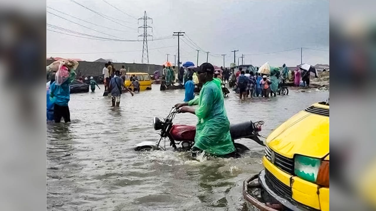
* Residents blame conversion of green spaces, poor waste management as flooding hits Wuse 2, Gudu, Mabushi, Lugbe, Gwarampa, others
* FCT emergency agency warns residents against driving into floodwater
Some parts of Abuja, the country’s capital, have been hit by flooding following heavy rainfall, raising fresh concerns over the state of drainage infrastructure, waste disposal and the preparedness of authorities to manage the capital’s recurring flood risks.
Findings showed that the latest flooding was reported in parts of Wuse 2, Katampe, Mabushi, Lugbe, Nyanya, Gwarimpa, Asokoro, Maitama, Utako, Wuye, Gudu and around the bridge linking Gaduwa and Durumi, with motorists and residents affected by rising water.
In Wuse 2, residents reported significant accumulation of floodwater on roads and surrounding areas after the downpour on Sunday. Some social media reports also claimed that expensive vehicles were submerged, although no official damage assessment had been released.
At the Gudu area, the Delight Event Centre was reportedly heavily flooded, while the bridge linking Gaduwa and Durumi was also inundated, leaving motorists stranded.
The flooding has renewed concerns about Abuja’s ability to cope with intense rainfall, particularly in areas where drainage channels are inadequate, poorly maintained or obstructed by refuse.

The Guardian reports that although the immediate trigger was heavy rainfall, experts and government agencies have repeatedly identified a combination of human and environmental factors that can turn intense rainfall into flash floods.
The National Emergency Management Agency (NEMA) had earlier warned that prolonged rainfall and saturated soil conditions could increase the likelihood of rapid surface runoff, particularly in low-lying communities and urban centres with inadequate drainage systems in Abuja and other parts of the country.
The agency also specifically advised residents to clear drainage channels and waterways and avoid indiscriminate disposal of refuse.
The problem is particularly significant in Abuja, where rapid urbanisation has increased the amount of paved and built-up surfaces. Residents and environmental observers say the problem is compounded by poor waste management.
According to them, plastic bottles, nylon bags, food waste, sand and other debris dumped around roads and drainage channels can obstruct the movement of stormwater.
There are also concerns about urban planning and enforcement. Abuja’s expansion has brought intense development into areas that may not have adequate supporting infrastructure. Where buildings, roads or other structures interfere with natural water channels, runoff can become concentrated in neighbouring areas.
Residents have consequently questioned whether flood prevention is receiving sufficient attention before the rainy season rather than after flooding has occurred.
The development has also triggered concerns over the continued conversion of Abuja’s designated green areas and waterways for residential and commercial developments, with some residents linking the practice to the worsening drainage problems in the Federal Capital Territory.
Abraham Bello said, “All the converted GREEN AREAS in Abuja may be contributing to the current flooding the FCT is experiencing, a situation unlike any seen in Abuja before.”
According to Bello, the conversion of green areas could be reducing the city’s natural capacity to absorb and channel rainwater, thereby increasing surface runoff and putting additional pressure on existing drainage infrastructure.
Similarly, Ahmad Rufai said, “We are now witnessing the consequences of allocating Green Areas and Waterways for residential and commercial buildings in Abuja.”
Rufai further blamed the situation on poor public services, particularly waste management and sewage maintenance, saying, “Coupled with poor service delivery especially waste management and sewage cleaning.”
Their concerns have added to growing calls for the FCT authorities to review developments around green areas and waterways, improve drainage and waste management, and enforce planning regulations to prevent further obstruction of natural water channels.
In an interview with The Guardian, the Head, Public Affairs, FCT Emergency Management Department, Nkechi Isa, said the agency had intensified flood preparedness and public sensitisation across the Federal Capital Territory, following early warnings from the Nigeria Meteorological Agency (NiMet) and the Nigeria Hydrological Services Agency (NIHSA).
Isa said the seasonal climate prediction issued by NiMet and the annual flood outlook released by NIHSA served as early warning documents that guided the agency’s preparations.
She said FCT authorities immediately convened a stakeholders’ meeting involving the National Emergency Management Agency, Engineering Services Department, Department of Development Control, FCT Fire Service, Red Cross and Satellite Towns Development Department to review previous flooding experiences and agree on measures to mitigate the impact of the rains.
She said the agency subsequently visited flood-prone communities, including Lugbe and Mabushi, where residents had experienced severe flooding, while also assessing preparedness in areas identified by NIHSA as vulnerable.
According to her, the agency had visited Gwagwalada and Kwali Area Councils, where it sensitised residents, engaged traditional institutions and assessed locations considered prone to flooding, with Abaji also identified among the three area councils at risk.
Isa said the FCT authorities had also intensified awareness campaigns through radio and television, urging residents to clear their drainage channels, avoid building along waterways and relocate from floodplains to safer, higher ground.
She stressed that residents should also report developments that obstruct the natural flow of water, noting that a case involving a developer allegedly blocking a water channel in Mabushi had already been reported to the relevant authorities.
“We have been going round, sensitising people and creating awareness. We have also been telling people to clear their drains and warning those who live along the floodplain to move to higher ground to avoid loss of lives and property,” she said.
Isa listed Mabushi, Lugbe, parts of Gwarinpa, Wuye, Nyanya and parts of Gwagwalada among locations where flooding had been reported, noting that the situation was particularly severe around a residential structure on Anthony Kemp Street in Mabushi. She said floodwater had risen to window level and entered the building, but the owner had since taken some mitigation measures, while residents occupying the ground floor had relocated to a safer location.
She urged residents to exercise extreme caution whenever they encounter flooded roads, warning that the depth of the water may be unknown and could be accompanied by flash floods capable of sweeping away people and vehicles.
“Please do not drive into flooded roads, and do not even walk into them. Do not ride your motorcycle or drive your vehicle into floodwater because you do not know the depth and there could also be a flash flood. For your own safety, clear your drains and, if you live in a low-lying area or along a water channel, please relocate,” the Spokesperson said.